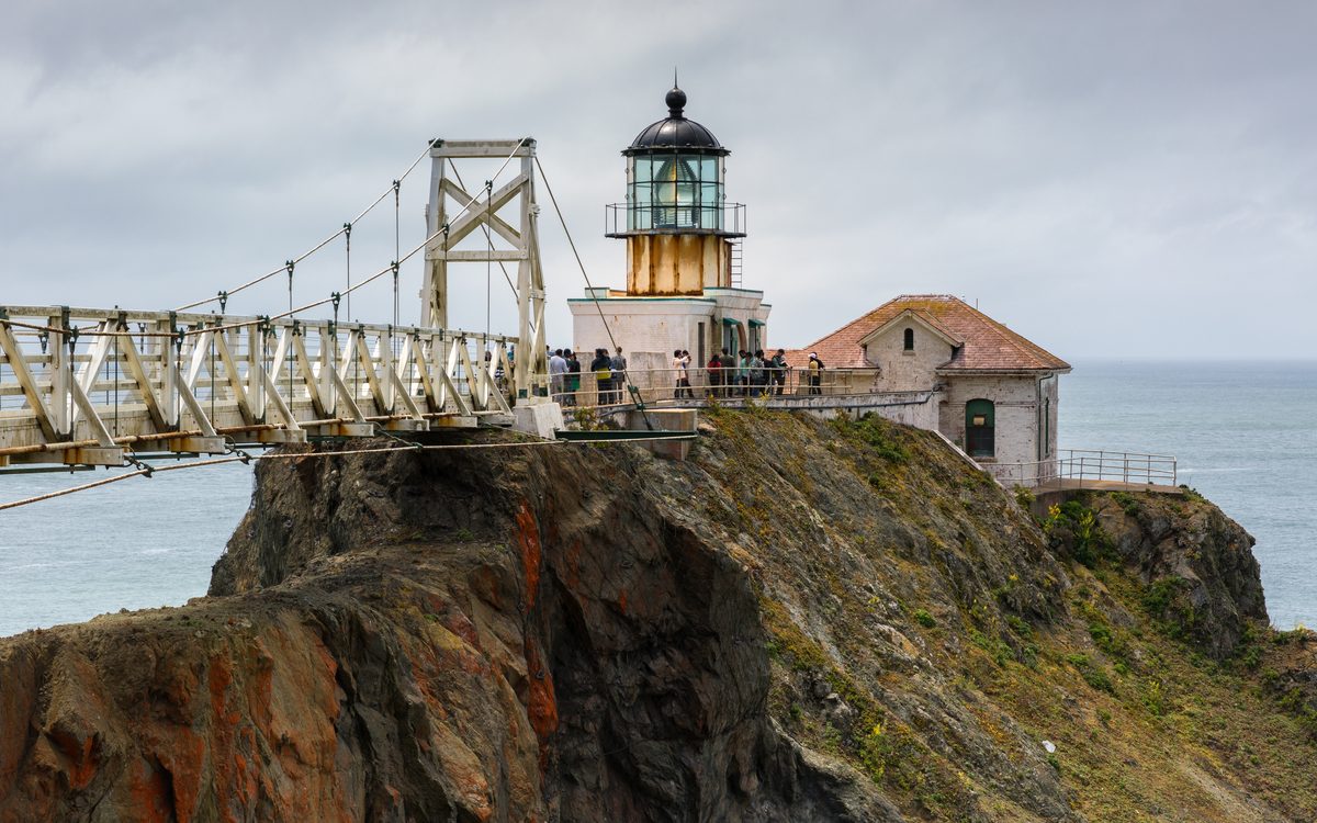
You've seen Highway 1's bridge and cliffs on a thousand phone screens. What the postcards skip is how odd this coast gets once you pull over. There's a lighthouse reached through a tunnel whose builders went unrecorded, a Navy base that listened for Soviet submarines, a beach streaked with purple, and zebras grazing below a castle.
The nine stops below run north to south, from the Marin Headlands to the Guadalupe dunes. We checked each one against its park, agency or museum site in mid-October 2026. Several keep narrow visiting windows, so the times matter as much as the miles.
Start with the road report
Good news first: Highway 1 is open through Big Sur. Landslides kept the road between Carmel and Cambria broken for most of three years, until Caltrans reopened Regent's Slide on January 14, 2026. After one more storm cleanup, through travel returned on February 20.
Expect stoplights in the middle of nowhere, though. As of October 15, Caltrans lists one-way traffic control around the clock at Rocky Creek Bridge, just north of Bixby, through November 30. Add signals near Point Sur, where crews are repairing a failed embankment, near Torre Canyon Bridge in daytime, and at Mud Creek on weekday mornings. Caltrans quotes delays of up to 20 minutes at some of them.
This summer's Timber and Plaskett fires left their mark too. Monterey County lifted all Timber Fire evacuations and warnings on October 7, and coastal day-use areas have reopened, but trails east of the highway stay closed. Check Caltrans QuickMap the morning you drive.
Point Bonita Lighthouse: through the tunnel
Just across the Golden Gate Bridge, in the Marin Headlands, a steep half-mile trail drops toward a lighthouse that's guarded the Golden Gate since 1855. The approach is the strange part. The path runs through a tunnel carved by hand through pillow basalt, and the National Park Service says plainly that no one knows who dug it. One theory the park shares is that Chinese immigrant laborers did the work for very little pay.
It's windy enough that early keepers tied their playing children to a post by harness. Rangers call the slope by the tunnel exit Hat Cliff, for the caps the wind has parked there.
Timing is everything. The trail opens only on the third Saturday of the month, 12:30 to 3:30 p.m., with a ranger talk at 12:15: October 17, November 21 and December 19 for the rest of this year. The suspension bridge to the lighthouse is closed for safety until further notice, so you'll see the light from the viewing platform. It's free; pets and bikes stay at the trailhead.
Visit details: nps.gov/goga/pobo.htm
Point Lobos: orange trees and a whalers' cabin
Three miles south of Carmel, Point Lobos State Natural Reserve looks like pure wilderness. It once held a whaling station and what State Parks calls the largest abalone cannery on the West Coast.
Start at Whalers Cove. The Point Lobos Foundation says Chinese fishermen built the Whalers Cabin there in the 1850s, and whalers worked the cove from 1862 to 1879. The cabin and the Whaling Station Museum next door open when docents are on hand.
Then walk the Cypress Grove Trail, one of only two native Monterey cypress forests left. Trees nearest the salt spray wear a rust-orange coat. It's Trentepohlia, a green alga full of the pigments that color carrots, and it's harmless to the trees.
The reserve is open 8 a.m. to 7 p.m. (last entry 6:30), $10 per car. Dogs stay home. Park info: parks.ca.gov
Bixby Creek Bridge: the drive-by landmark
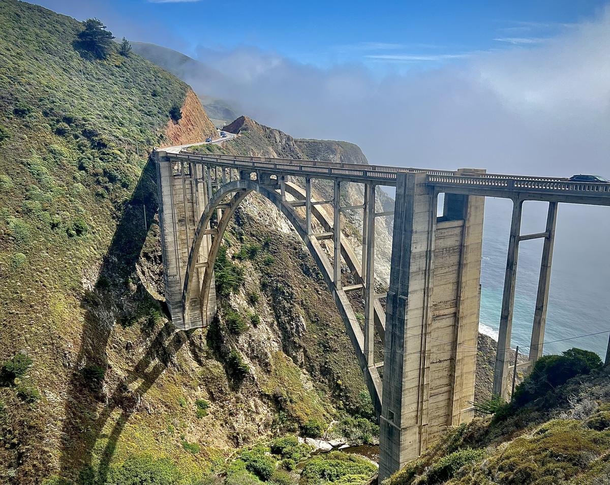
Bixby is the famous one, so why is it here? Because in 2026 it became a landmark you enjoy at road speed. Built in 1932, it carries Highway 1 about 714 feet across Bixby Creek, 15 miles south of Carmel.
On June 23, 2026, Monterey County banned parking on both sides of the highway from about 900 feet north of the bridge to 700 feet south, to ease congestion and clear the way for emergency vehicles. So take it in through the windshield and let a passenger handle the photos. The signal at nearby Rocky Creek Bridge slows things down for a good look anyway.
Point Sur: a light station and a Cold War listening post
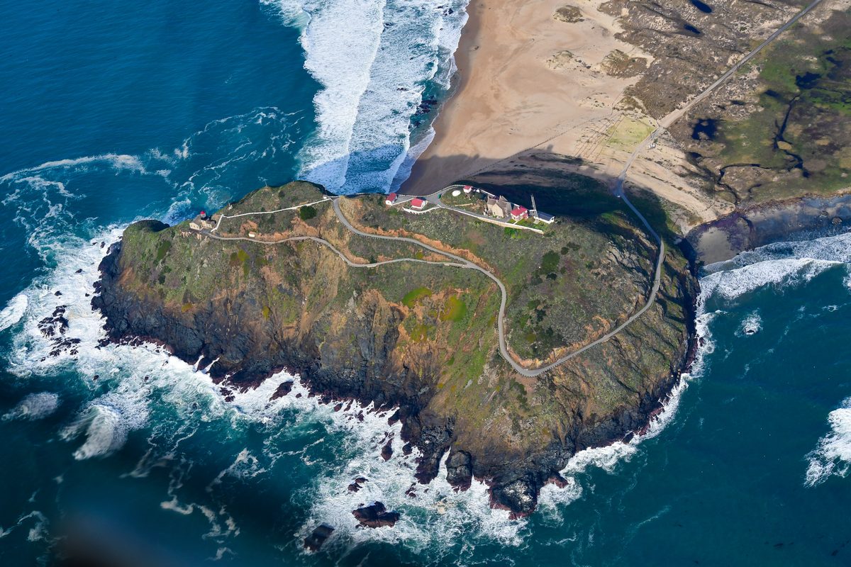
Nineteen miles south of Carmel, a 361-foot volcanic rock rises off the beach with a full light station on top. First lit in 1889, it housed keepers' families until 1974, and State Parks calls it the only complete turn-of-the-century light station open to the public in California.
Just down the road sits something stranger. The Point Sur Naval Facility opened in 1958 as one of a worldwide network of listening stations that tracked Soviet submarines, and State Parks says it's the only such site on the West Coast open to the public.
Docent tours are the only way in. The three-hour light station tour climbs 360 feet and leaves Saturday at 10 a.m. and 2 p.m., Sunday at 10 a.m. and Wednesday at 1 p.m.; it's $20 for adults and $10 for ages 6 to 17. The two-hour naval facility tour starts at 10:30 a.m. on weekends for $10. Space is limited and the repair zone sits nearby, so call (831) 625-4419 before you go.
Tour details: parks.ca.gov
Pfeiffer Beach: purple sand and a keyhole
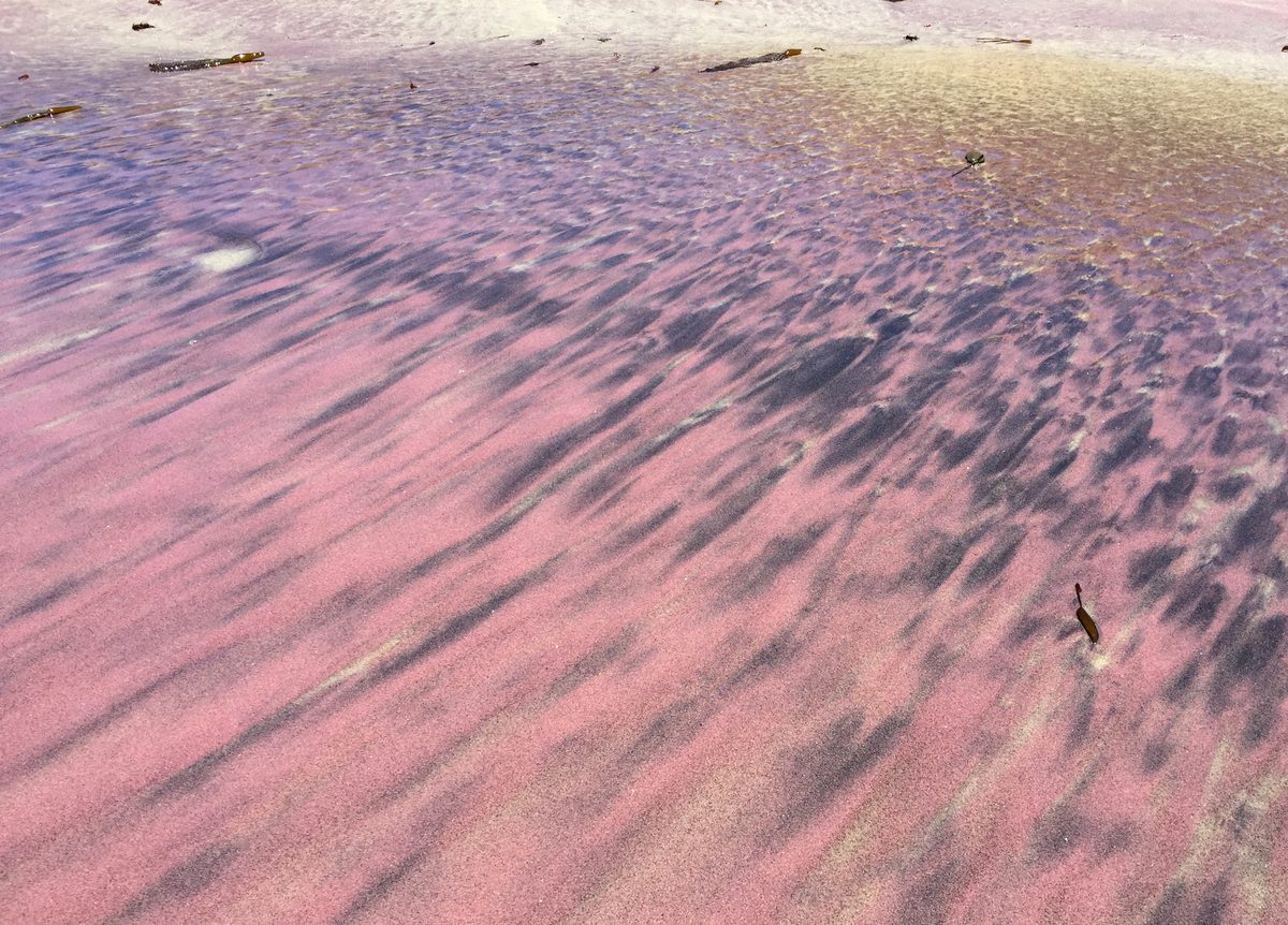
Sycamore Canyon Road is easy to miss. It leaves Highway 1 between the Big Sur Ranger Station and the post office, runs a single lane for about two miles, and through January 2027 it's open to cars only. The 65-space lot fills on summer weekends.
At the bottom, look down. Streaks of purple swirl through the tan sand. UC Santa Cruz coastal geologist Gary Griggs explains Big Sur's purple sand as garnet, a hard mineral that weathers out of metamorphic rock in the Santa Lucia Range and gets sorted into patterns by the waves. Keyhole Rock, the arch just offshore, is the other draw.
It's day use only, $15 per car, and interagency passes don't apply. Treat it as a beach for walking; the Forest Service warns of cold water, rocks and riptides. Details: fs.usda.gov
Julia Pfeiffer Burns: a waterfall that lands on the beach
Thirty-seven miles south of Carmel, McWay Creek skips the usual river mouth and drops 80 feet off a cliff onto the sand of McWay Cove. An accessible trail leads to the overlook. The falls and beach are off-limits, so the view is the visit.
Farther north in the park, the Partington Cove trail heads down to the site of a former tanbark shipping port, and you reach it through a tunnel blasted through rock. State Parks lists the day-use areas and the Partington trail as open; trails east of the highway stay closed after the fires. Day use is $10. Park info: parks.ca.gov
Piedras Blancas: an elephant seal colony beside the road
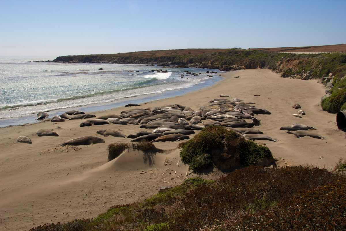
Elephant seals were hunted nearly to extinction by the 1890s. In 1990 they began hauling out south of the Piedras Blancas lighthouse, and the first pup was born there in February 1992. Today the rookery covers about 8 miles of beach.
The free viewing area sits 4 miles north of Hearst Castle, with platforms steps from the lot. Adult males reach 16 feet and 5,000 pounds. Late October is one of three yearly peaks, when juveniles return for the fall haul-out. Docents are on hand 10 a.m. to 4 p.m.; there are no restrooms, so stop in San Simeon first.
Visitor info: elephantseal.org
Hearst Castle and the zebras of San Simeon
William Randolph Hearst and architect Julia Morgan worked on the hilltop estate for almost 30 years, starting in 1919, and the main house alone has 115 rooms. The small details are odder than the scale. In the Refectory, a dining hall made to feel like a medieval monastery, the table still holds bottles of ketchup and mustard, because Hearst liked to keep things informal at his ranch.
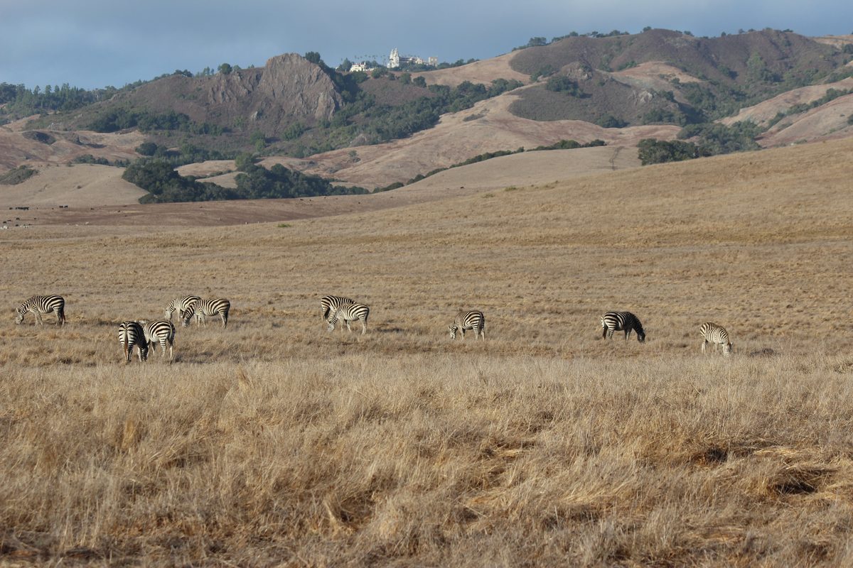
Hearst also kept a zoo, with zebras, camels and kangaroos on the hillsides and lions in cages. Hearst Castle says the breakup that began in 1937 was never finished, and zebras still graze the pastures along Highway 1 near San Simeon, especially in warm weather. The ranch is private, so watch from a safe pullout.
The 70-minute Grand Rooms Tour costs $35 for adults and $18 for kids 5 to 12, including the 15-minute bus ride up the hill. Reserve at hearstcastle.org or (800) 444-4445.
Guadalupe: the Egyptian city buried in the dunes
Highway 1 runs right through Guadalupe, a farm town at the north edge of Santa Barbara County. In 1923 Cecil B. DeMille built the City of the Pharaoh in the nearby dunes for his silent epic The Ten Commandments, and the Dunes Center calls it the largest set in movie history. When filming wrapped, DeMille had the whole thing taken apart and buried in the sand.
Film buffs following a clue in DeMille's autobiography found it in 1983, and in 2018 the Dunes Center unveiled a giant terracotta-colored sphinx head dug from the site. Its Lost City of DeMille exhibit shows artifacts from the set and crew, plus a short film on the recovery.
The center, at 1065 Guadalupe Street, is open Tuesday through Saturday, 10 a.m. to 3 p.m.; admission is $7, free for kids 12 and under. The set itself stays under the sand. Details: dunescenter.org
How to string them together
Build the trip around Point Bonita's Saturday window. Point Lobos, Bixby, Point Sur and Pfeiffer Beach fill a day out of Carmel; Julia Pfeiffer Burns, the seals and Hearst Castle make a second day ending in San Simeon or Cambria. Guadalupe is a good last morning heading south. (San Francisco's Wave Organ gets its own story soon.)
Carry a current California road atlas, since cell signal comes and goes in Big Sur, and a pair of compact binoculars for the seals and zebras.
Before you go
- Plan around the fixed windows. Point Bonita opens one Saturday a month, Point Sur tours run Wednesdays and weekends, and the Dunes Center opens Tuesday through Saturday.
- Check QuickMap the morning you drive. Budget extra time for one-way signals at Rocky Creek Bridge, Point Sur, Torre Canyon and Mud Creek.
- Stay on the ocean side in Big Sur. Trails east of Highway 1 remain closed after the fires. Pfeiffer Big Sur State Park reopens October 16 with some trails still closed.
- Keep rolling at Bixby. Parking is banned for about 900 feet north and 700 feet south of the bridge.
- Give wildlife and ranchland room. Watch the seals from the platforms and the zebras from a safe pullout; Hearst Ranch is private property.
Highway 1 rewards the stops more than the speed. Walk the tunnel at Point Bonita, take the Cold War tour at Point Sur, and give the zebras a few minutes to wander into view.
Looking for more unusual California trips? Start at our California hub, or see unique places in California, our California Route 66 oddities road trip, and California ghost towns.
More California: California state guide · The most unique places in California · California scenic road trip · California ghost towns · California Route 66 oddities road trip · Yosemite firefall guide · California places with a haunted reputation · Oregon Coast oddities road trip