Washington's oddest landscapes come from two very different kinds of violence. On the west side, Mount St. Helens sent runny lava through an old forest and left a tunnel you can walk through. On the east side, floods from a broken ice dam in Montana tore across the state at the end of the last ice age and left canyons with no rivers in them. And south of Olympia there's a prairie of grassy bumps that scientists still argue about.
All seven stops are open to the public. We checked seasons, fees and closures on official pages on October 27, 2026, an awkward week for it: Ape Cave shuts for winter on November 1, and the Dry Falls Visitor Center is closed for renovation through year's end.
Ape Cave: walk through a lava tube from Mount St. Helens
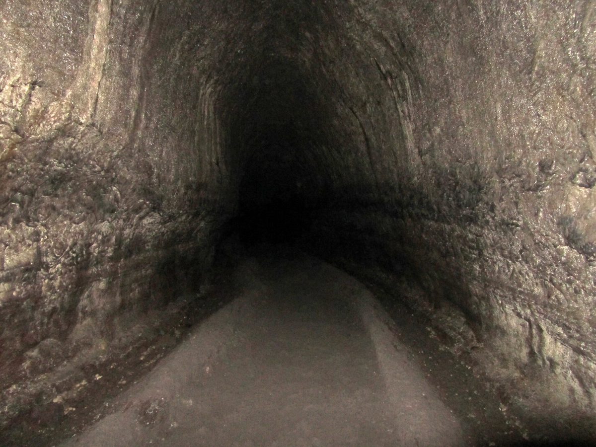
Ape Cave runs 2.5 miles under the forest on the volcano's south side, and the Forest Service ranks it the third-longest lava tube in North America. Fluid pahoehoe lava crusted over on top and kept flowing underneath, then drained out and left the tunnel. A Forest Service brochure dates the eruption to about 1,900 years ago. A logger, Lawrence Johnson, found the entrance in the 1940s, and the St. Helens Apes, a local group of young outdoorsmen, explored it and gave it their name.
The lower cave is ¾ mile one way on a mostly level, sandy floor. Look up for the Lava Ball, a chunk of cooled lava that rode the flow and jammed in the passage about 12 feet up. The upper cave is 1.5 miles of boulder piles and an 8-foot lava wall, then a 1.5-mile walk back on the surface. It's 42°F inside all year, and the Forest Service wants two lights per person, since a phone's light is too dim.
Visit: Forest Road 8303, about 9 miles east of Cougar. (360) 449-7800. fs.usda.gov. Open 9 a.m. to 5 p.m. through October 31, 2026, then closed to everyone until May 17. In season you need a two-hour timed ticket from Recreation.gov, one per vehicle, $2, plus a $5 day pass or a Northwest Forest or interagency pass. Each vehicle can book six times a season. Pets and food stay outside, and keep your hands off the walls; touching them kills the cave slime that feeds the cave's tiny residents.
Trail of Two Forests: crawl through the shape of a tree
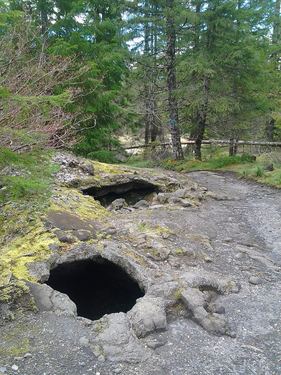
Half a mile down the road, the same lava ran into a stand of trees. The trunks burned, the lava hardened around them, and the wood rotted away, leaving tree wells with the bark pattern pressed into the rock. Fir, hemlock and bright moss now grow on top. A quarter-mile boardwalk crosses the flow, and partway around, a ladder drops into a hollow mold you can crawl through on hands and knees. If you're bringing kids, save time for this one, and pack a flashlight.
Visit: Forest Road 8303, half a mile from Forest Road 83. fs.usda.gov. Sunrise to sunset. Same $5 day pass or forest passes as Ape Cave. Leashed pets are welcome. Parking is tight, so leave the RV behind, and stay on the boardwalk.
Mima Mounds: the bumps scientists still argue about
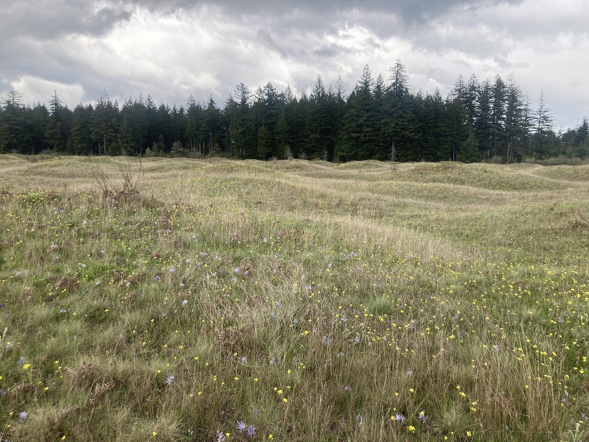
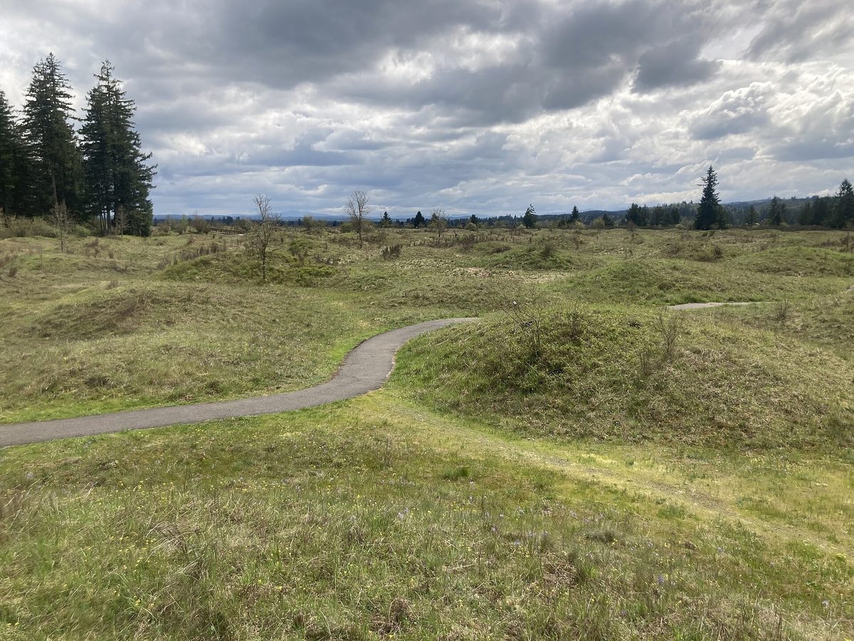
The prairie at Mima Mounds Natural Area Preserve looks like an egg carton under grass. The mounds stand 1 to 7 feet tall and 8 to 40 feet across, made of black soil and rounded gravel, on outwash that glacial meltwater spread here after the last ice sheet began retreating about 16,500 years ago.
How they got their shape is still open. DNR says more than 30 explanations have been proposed and none has been proven. Charles Wilkes of the U.S. Exploring Expedition opened three in 1841, hoping for graves, and reported that “nothing was found in them but a pavement of round stones.” J Harlen Bretz, who you'll meet again at Dry Falls, suggested in 1913 that gravel settled out of pits in melting ice. A 1940s idea, that pocket gophers piled them up while digging nests, still has researchers working on it, and others point to permafrost cracks or earthquake shaking. The interpretive signs lay them all out.
A paved, wheelchair-accessible half-mile loop and two gravel paths cross the 756-acre preserve, a National Natural Landmark since 1966. The gunfire you may hear comes from a target range next door.
Visit: Waddell Creek Road SW near Littlerock, southwest of Olympia, via I-5 Exit 95 and Highway 121. dnr.wa.gov. Open 7 a.m. to dusk; the gate is locked otherwise. Discover Pass required, $10 a day or $45 a year. Only service dogs are allowed.
Ginkgo Petrified Forest: logs turned to stone by lava
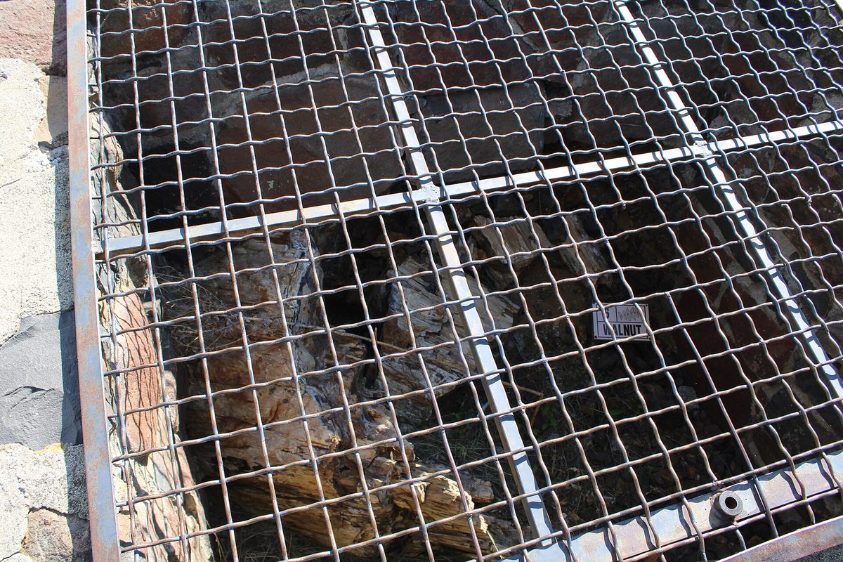
About 15 million years ago, this corner of central Washington was a warm swamp with elm, walnut and ginkgo trees, plus spruce and Douglas fir that rivers and mudflows washed in. State Parks calls it a “rafted forest.” A lava flow ran into the swamp, cooled into pillow lava and sealed the logs off from air, and silica from the basalt slowly replaced the wood.
On November 29, 1932, George Beck, a teacher at the Ellensburg normal school, and four students dug up what proved to be the first complete petrified ginkgo log on record. He pushed for a park with the logs left in place, and the Civilian Conservation Corps built the Trailside Museum and the Trees of Stone Interpretive Trail in the late 1930s. The logs still lie under protective cages.
At the interpretive center, look for the petroglyphs out front. Wanapum Dam's reservoir was about to flood their cliffs, so in 1958 and 1959 a retired mason, Bob Atwell, cut them out and floated them across the Columbia on a raft. Nearly 100 images made the trip.
Visit: Interpretive Center at 630 Ginkgo Ave., Vantage, with the trailhead 2 miles west. (509) 856-2290. parks.wa.gov. Park open 8 a.m. to dusk in winter; Discover Pass required. The center is free, open Friday to Sunday, 10 a.m. to 4 p.m., through December 23 (closed October 31 and November 1), then Sundays only until March 31.
Dry Falls: a waterfall cliff 3.5 miles wide
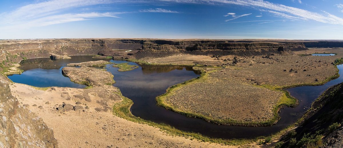
Dry Falls is a horseshoe of basalt cliffs 3.5 miles wide and more than 400 feet tall. During the Ice Age floods, water poured over it, and State Parks puts that waterfall at five times the width and more than twice the height of Niagara. Its old plunge pools hold small, groundwater-fed lakes.
The water came from Glacial Lake Missoula in Montana, behind an ice dam that failed again and again. Bretz argued in 1923 that a giant flood carved this country, and established geologists called it an “outrageous hypothesis.” Joseph Pardee's work on Lake Missoula supplied the water source in 1940, and in 1965 visiting geologists sent the 83-year-old Bretz a telegram: “We are all now catastrophists.” Dry Falls is now on the International Union of Geological Sciences' list of the first 100 geological heritage sites.
This fall, see it from below. The visitor center, its restrooms, parking lot and outdoor overlook are closed for a renovation scheduled to finish December 31. State Parks says the falls are still visible from Sun Lakes-Dry Falls State Park at the foot of the cliffs.
Visit: Sun Lakes-Dry Falls State Park, 34875 Park Lake Road NE, Coulee City, off Highway 17. (509) 632-5583. parks.wa.gov. Winter hours 8 a.m. to dusk; Discover Pass required. The Dry Falls Lake gate closes December 1. For the visitor center's reopening, check its page.
Lake Lenore Caves: shelters the floods pulled out of a cliff
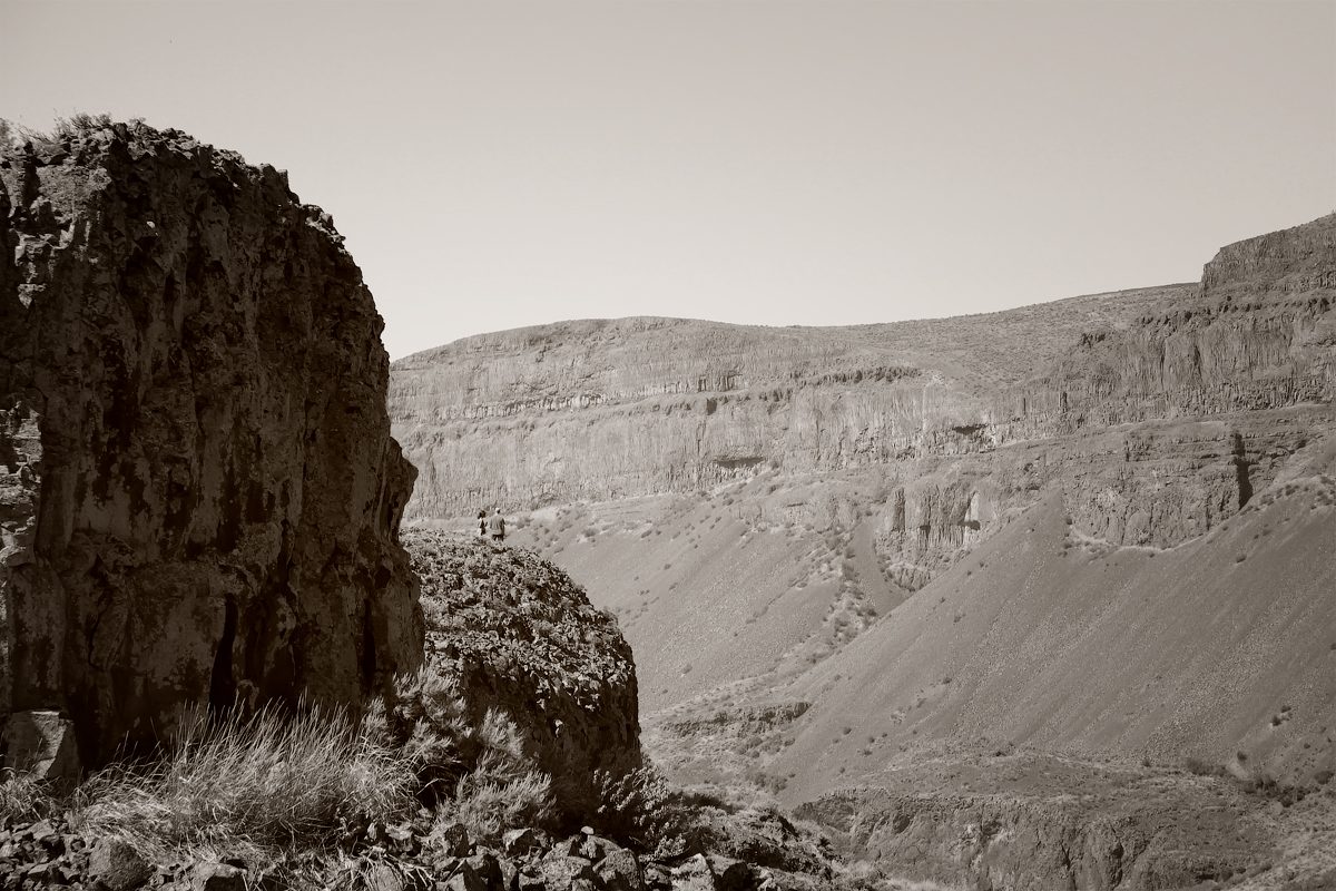
Ten miles south on Highway 17, the floods ran down the Lower Grand Coulee and plucked columns of basalt from its east wall, leaving shallow alcoves. State Parks prefers “rockshelters,” since daylight reaches the back. Archaeologists who surveyed Grand Coulee shelters from 1958 to 1961 found pictographs, rope, baskets, mats and stone points, and also found that looters had dug up more than a foot of the floor here. Artifacts are protected by law now, so leave everything in place.
Visit: Off Highway 17 at the north end of Lake Lenore. parks.wa.gov. Day use; Discover Pass required. The trail is roughly a mile round trip, with one short, steep stretch.
Palouse Falls: the flood channel that still has a river
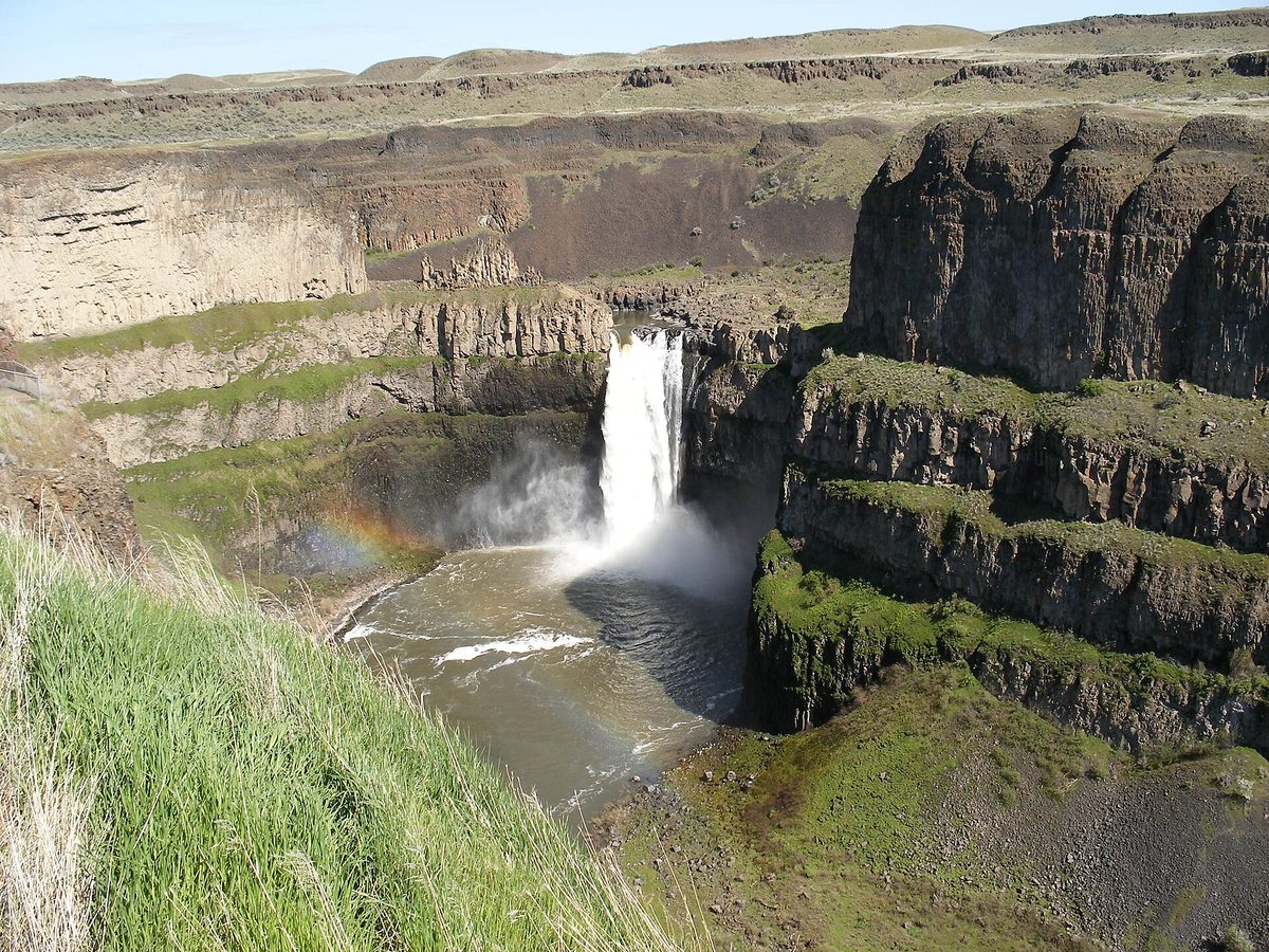
At Palouse Falls, the Palouse River still runs through a flood channel, dropping 200 feet into a churning bowl and racing through a gorge of columnar basalt to the Snake. State Parks says the canyon was carved more than 13,000 years ago. It's Washington's official state waterfall.
There are three viewpoints, from a lower one by the day-use area to the high Fryxell Overlook. All trails into the canyon and to the base of the falls are permanently closed, and going past the viewing areas is prohibited.
Visit: Palouse Falls Road, LaCrosse. (509) 646-3229. parks.wa.gov. Day use, 8 a.m. to dusk in winter; Discover Pass required. Since October 6, 2026, there's been no drinking water during maintenance, so bring your own. Parking is very limited, RVs and trailers are prohibited, and cell service is scarce.
Before you go
- Carry the right pass. The two Mount St. Helens stops take a $5 day pass, a $30 Northwest Forest Pass or an interagency pass. The rest take a Discover Pass, good on State Parks and DNR land.
- Watch the calendar. Ape Cave reopens May 18 with tickets on Recreation.gov, so check there in spring. The Dry Falls renovation is scheduled to wrap up December 31.
- Pack for a cold cave. Bring a warm layer and two lights each. A headlamp keeps your hands free on the boulder piles, and a Washington road atlas helps in the coulees, where cell service drops out.
- Make it two trips. Ape Cave, Trail of Two Forests and Mima Mounds suit a west-side weekend off I-5. Ginkgo, Dry Falls, Lake Lenore and Palouse Falls make an east-side loop through the scablands.
There's still time for Ape Cave before its gate closes Saturday. The mounds, the stone logs and the dry cataract will wait for spring, and State Parks expects the Dry Falls Visitor Center back this winter.
Sources
- USDA Forest Service, Gifford Pinchot National Forest: Ape Cave Interpretive Site and Ape Cave Resource Protection Restrictions (Order 06-03-05-26-01): fs.usda.gov
- Ape Cave Interpretive Site timed tickets: recreation.gov
- USDA Forest Service, Mount St. Helens National Volcanic Monument, "Ape Cave" brochure: npshistory.com (PDF)
- USDA Forest Service, Gifford Pinchot National Forest: Interpretive Site: Trail of Two Forests: fs.usda.gov
- Washington DNR: Mima Mounds Natural Area Preserve: dnr.wa.gov
- Washington DNR, "Mima Mounds: The Mysterious Work of Nature": dnr.wa.gov (PDF)
- Washington State Parks: Ginkgo Petrified Forest State Park, Interpretive Center hours, and park history: parks.wa.gov
- Washington State Parks: Sun Lakes-Dry Falls State Park and park history: parks.wa.gov
- Washington State Parks: Dry Falls Visitor Center and renovation project page: parks.wa.gov
- Washington State Parks, "Dry Falls internationally recognized as scientifically significant geologic site," April 26, 2023: parks.wa.gov
- Washington State Parks: Lake Lenore Caves State Park Heritage Site History: parks.wa.gov
- Ice Age Floods National Geologic Trail: Lenore Lake Caves (trail length): iceagefloodstrail.org
- Washington State Parks: Palouse Falls State Park Heritage Site: parks.wa.gov
- Washington State Parks: Winter Schedule 2026-27: parks.wa.gov
Looking for more unusual Washington trips? Start at our Washington hub, find Dry Falls and Palouse Falls in the most unique places in Washington, or see Washington's themed and oddball towns.
More Washington: Washington state guide · The most unique places in Washington · Washington scenic road trip · Washington's themed and oddball towns · Washington places with a haunted reputation