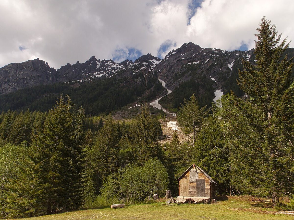
Miners gave up on Monte Cristo after floods kept wrecking their railroad. The Army left Fort Casey's batteries facing an empty strait. And in 1943 the government told the people of White Bluffs, an orchard town, to leave.
A lot of Washington's ruins sit on private timberland, so this list sticks to seven places where you're welcome. We checked access, passes and seasons on official pages on October 29, 2026, and a few are about to close for winter.
Fort Casey: gun batteries for a war that never came
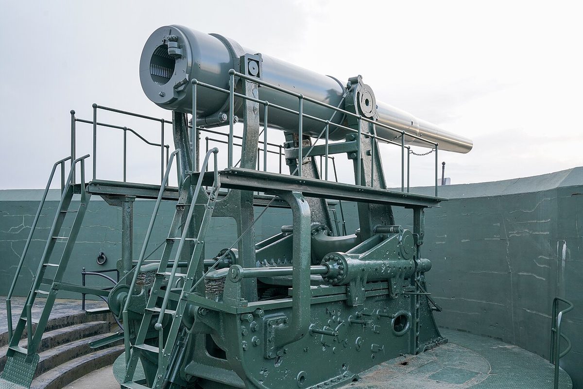
In 1896 Congress ordered three forts to guard Admiralty Inlet, the entrance to Puget Sound. Fort Casey, on Whidbey Island, was fully operational by 1902. Its biggest guns sat on "disappearing carriages" that raised the barrel over a concrete wall to fire, then dropped it out of sight to reload. None of its 35 guns was ever fired at an enemy. Warships and airplanes outran them by the 1920s, the big guns went for scrap in 1942, and the Army left in 1953.
The batteries stayed. You can roam the gun platforms and the dim concrete rooms behind them, so bring a flashlight. The two 10-inch disappearing guns on display came from Fort Wint in the Philippines in 1968, the same type that once stood here.
Visit: 1280 Engle Road, Coupeville. (360) 678-4519. parks.wa.gov. Open 8 a.m. to dusk all year. Discover Pass required ($10 a day). The park's 1903 Admiralty Head Lighthouse opens noon to 4 p.m. on set days; the last 2026 dates are November 27 to 29.
Northern State: a hospital farm going back to the blackberries
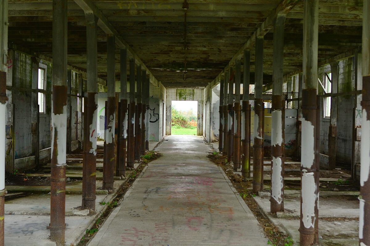
Northern State Hospital, a state mental hospital outside Sedro-Woolley, got its first permanent building in 1912 and ran its own dairy farm. By July 1973 only 194 patients were left, and it closed that September. Skagit County bought the farm from the state in 1991 for a park.
Northern State Recreation Area has more than 5 miles of flat gravel paths through pasture and woods. The old dairy barns still stand, and some smaller outbuildings are vanishing under blackberries. In winter, scan the fields for the North Cascades elk herd that comes down to the Highway 20 lowlands to feed.
Visit: Helmick Road, Sedro-Woolley: from Burlington, go 8 miles east on Highway 20, turn left on Helmick, and the lot is on the left within half a mile. Dawn to dusk daily, free.
Monte Cristo: a mining town at the end of a closed road
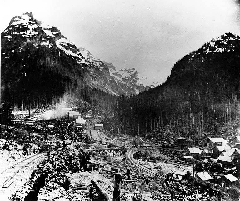
Joseph Pearsall staked the first claim here on July 4, 1889. Rockefeller money, a railroad from Everett and thousands of people soon followed. The ore was a letdown, rich at the surface and thinner the deeper anyone dug. Floods kept tearing out the tracks, and after the worst, in November 1897, residents walked out along the broken line. Mining limped on until Christmas 1920, when an avalanche smashed the last company's mine entrance.
Later owners ran it as a "ghost town" resort, until a 1980 flood cut the county road and the county let it go. Today the Forest Service and the volunteer Monte Cristo Preservation Association look after the cabins, foundations and rusted mining gear under a ring of jagged peaks.
You earn it. From Barlow Pass, walk or bike the gated road, the old railroad grade, about 4 miles each way; WTA lists 700 feet of gain. At about a mile the South Fork Sauk River has no bridge, so cross on the log or wade when the water's low. Parts of the road cross private claims, so stay on it.
Visit: Barlow Pass Trailhead, Mountain Loop Highway. (360) 691-7791 (Verlot Public Service Center). fs.usda.gov. $5 a day per vehicle or a Northwest Forest or interagency pass. Carry all your water: the Forest Service says local surface water holds arsenic and other heavy metals that filtering won't remove. Each winter the Mountain Loop closes to cars on the stretch that includes Barlow Pass; in 2024 the gates shut November 22.
Wellington: the railroad town that changed its name
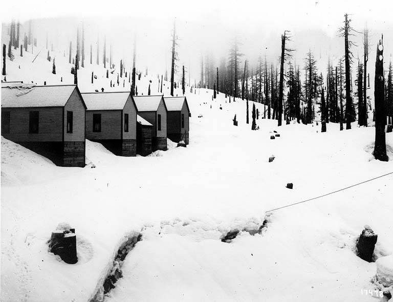
Wellington was a Great Northern railroad town by the first Cascade Tunnel near Stevens Pass. In late February 1910 a passenger train and a mail train sat stuck there for six days in a blizzard. After midnight on March 1, with the snow turned to rain and thunder, an avalanche came off Windy Mountain and swept both trains about 150 feet into the Tye River valley. Ninety-six people died. HistoryLink calls it the deadliest natural disaster in Washington's history.
The railroad renamed the town Tye and built snowsheds over nine miles of track. Then a longer, lower tunnel opened in 1929, the old grade was abandoned, and the town emptied. The grade is now the Iron Goat Trail.
From the trailhead, a 0.3-mile interpretive walk runs through a historic snowshed to a viewpoint over the disaster site. Old foundations and the old tunnel's west entrance are east of the lot. Walk it quietly; it's a memorial as much as a ruin.
Visit: US 2 to milepost 64.4, just west of Stevens Pass, then 2.8 miles north on the Old Stevens Pass Highway and right on Forest Road 050. Eastbound, drive to the pass and turn around, since sight lines at the turn are short. (360) 677-2414 (Skykomish Ranger District). fs.usda.gov. Sunrise to sunset; Forest Service recreation pass required. Snow lingers at 3,120 feet; the Forest Service lists July as the season's start.
Snoqualmie Tunnel: 2.3 miles under the pass
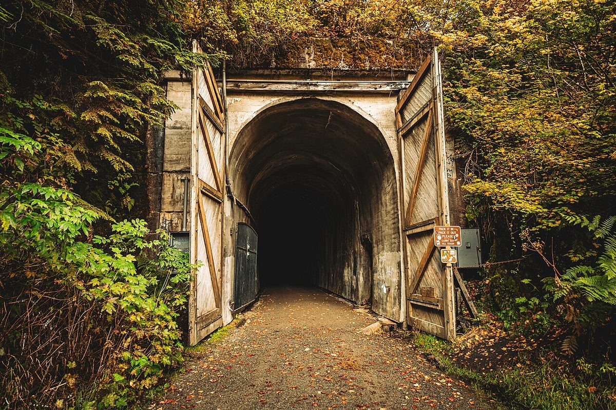
The Milwaukee Road bored this 11,890-foot tunnel under Snoqualmie Pass between 1912 and 1914. The railroad went bankrupt in 1977, Washington bought much of its route for a cross-state trail, and the tunnel reopened in 2011 on what's now the Palouse to Cascades State Park Trail.
Inside, it's dark nearly the whole way through, so everyone needs a strong light.
Visit: Hyak, off I-90 at Snoqualmie Pass. (425) 455-7010. parks.wa.gov. Discover Pass required; open 6:30 a.m. to dusk. The tunnel closes November 1, so Saturday, October 31, is the last day this year, and it's set to reopen around May 1, weather permitting.
Molson: the gold-rush town that moved half a mile
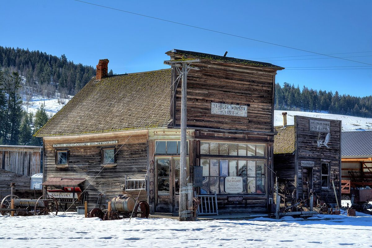
Promoter George Meacham founded the town near the Canadian border in 1898 with money from John W. Molson of the brewing family. He never registered title to the land. A local man named MacDonald did, then told everyone they were trespassing. The Molson Museums say people built a new Molson half a mile away and the two sites feuded for about 20 years. Somebody carried off the post office while the postmaster was at lunch, and the bank, built on skids, got dragged from lot to lot until it ended up in the new town. When the ore ran out in 1935, the railroad quit coming.
The original site is now Old Molson Ghost Town, an outdoor museum Harry Sherling started in 1960, with pioneer buildings, equipment sheds and old machinery on flat gravel. The Molson Schoolhouse Museum in town holds the indoor collection.
Visit: 539 Molson Road, about 15 miles northeast of Oroville via Chesaw Road. (509) 485-3292. molsonmuseums.org. The ghost town opens daylight hours, seven days a week; snow isn't plowed, so plan on spring through fall. The Schoolhouse Museum is open Memorial Day to Labor Day, 10 a.m. to 5 p.m.
White Bluffs and Hanford: the towns the Manhattan Project emptied
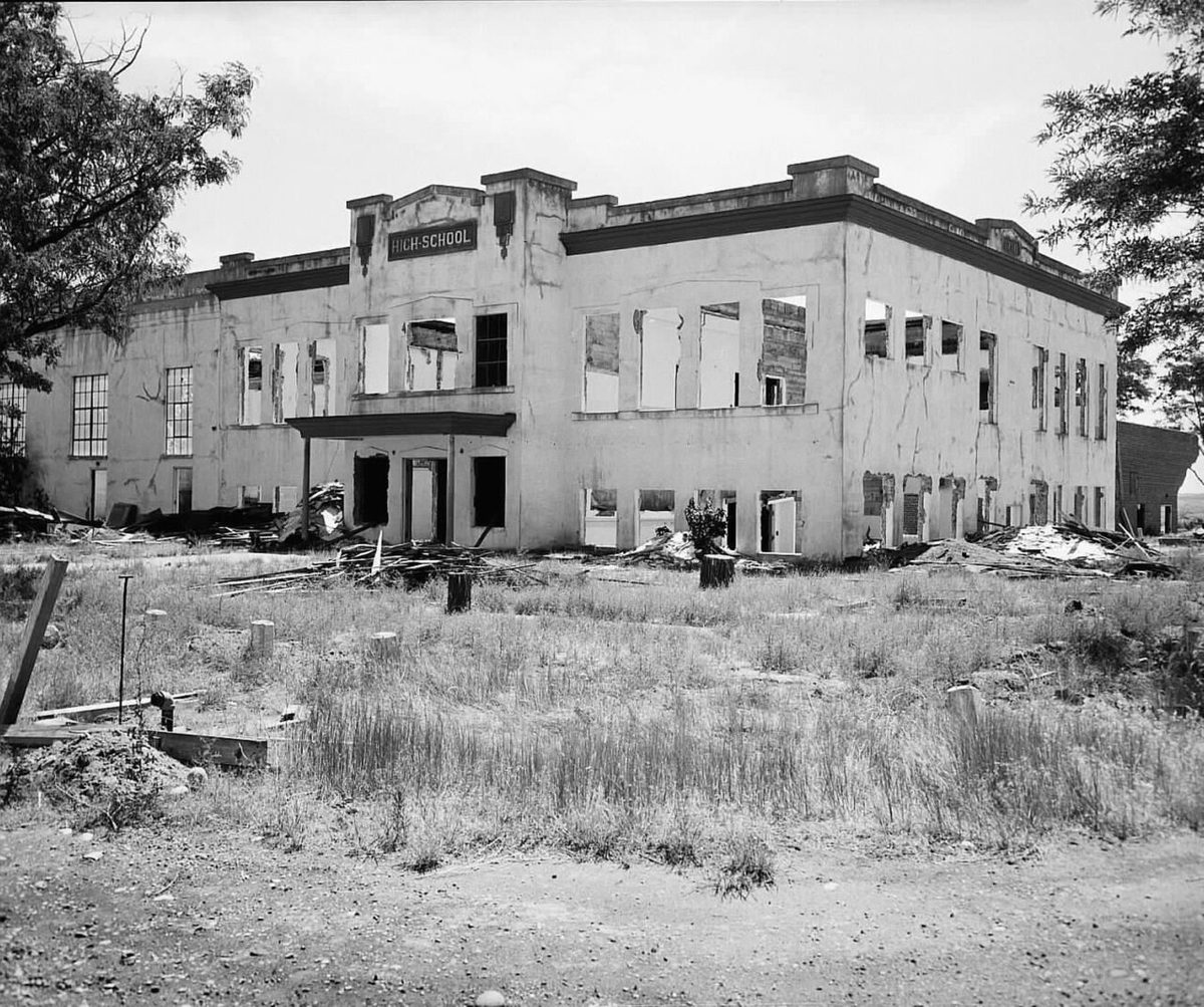
In 1943 the government used eminent domain to take the Columbia River farm towns of Hanford and White Bluffs for the Manhattan Project. About 1,500 residents lost their homesteads and orchards, the Department of Energy says, and Native American tribes were displaced too. Dick Wiehl, who grew up in White Bluffs, said its natural life "was truncated suddenly by Presidential decree," in words the Park Service quotes.
What's left sits inside the secured Hanford Site, and the way in is a free, four-hour Department of Energy bus tour. Stops include the Allard Pump House, the White Bluffs Ferry Landing, the 1916 Hanford High School, now a shell, and the First National Bank of White Bluffs. Built around 1908 and robbed twice, the bank is the only building left from White Bluffs. The bus also pauses outside the fence at B Reactor, the world's first full-scale plutonium production reactor.
Visit: Tours start at 2000 Logston Blvd., Richland. (509) 376-1647. tours.hanford.gov. Free, all ages. The 2026 tours ran May through September, with registration opening April 1; 2027 dates are still to come. B Reactor's own tours, paused for roof work, are projected to return in late summer 2027. Off-season, the Park Service suggests the White Bluffs Overlook on Hanford Reach National Monument.
Vance Creek Bridge: one to enjoy in photos
The Vance Creek Bridge in Mason County's Satsop Hills stands 347 feet above the creek, the second-highest railroad arch in the country. Simpson Logging Company built it in 1929, and it joined the National Register of Historic Places in 1982, long after its trains stopped. It sits on private Green Diamond Resource Company timberland, was never open to the public, and has lost its ties, gained barriers and caught fire on July 31, 2025. We found no public viewpoint, so it stays a history lesson.
So does Bordeaux, a logging town west of Mima Mounds whose mills closed in 1941 when the timber ran out. It's a protected archaeological site, mostly on private land, and the land manager asks people to stay away. Nearby Mima Mounds is in our Washington geologic oddities guide.
Before you go
- Carry the right pass. Fort Casey and the tunnel take a Discover Pass; Monte Cristo and Wellington take a Forest Service pass. Northern State and the Hanford tour are free.
- Watch the calendar. The tunnel closes November 1 and the Mountain Loop gates usually close in late November. Hanford registration opens in spring.
- Pack a light. A rechargeable headlamp keeps your hands free in the tunnel and the batteries, and a Washington road atlas helps where cell service fades.
- Leave the relics. The rusted mining gear at Monte Cristo belongs to the site. Take pictures instead.
Fort Casey's open all year and the tunnel through Saturday. The rest make a fine list for next summer.
Sources
- Washington State Parks: Fort Casey Historical State Park (hours, fees, lighthouse schedule): parks.wa.gov
- Washington State Parks: Fort Casey Historical State Park History: parks.wa.gov
- Cascadia Daily News, "Historic barns and brand new trails at Northern State Recreation Area," Jan. 20, 2026: cascadiadaily.com
- Northern State Hospital history project (Skagit County history): northernstatehospital.org
- HistoryLink, "Monte Cristo: Thumbnail History" (Essay 8404) and "Joseph Pearsall stakes the first mining claim in Snohomish County's Monte Cristo area on July 4, 1889" (Essay 7890): historylink.org
- USDA Forest Service, Mt. Baker-Snoqualmie National Forest: Old Monte Cristo Townsite Trail and Barlow Pass Trailhead: fs.usda.gov
- USDA Forest Service, "Mountain Loop Highway, Mt. Pilchuck Rd to Close for Winter," Nov. 21, 2024: fs.usda.gov
- Washington Trails Association: Monte Cristo Ghost Town and Bordeaux Ghost Town: wta.org
- HistoryLink, "Train disaster at Wellington kills 96 on March 1, 1910" (Essay 5127): historylink.org
- USDA Forest Service, Mt. Baker-Snoqualmie National Forest: Wellington Trailhead and Iron Goat Trail 1074: fs.usda.gov
- HistoryLink, "Palouse to Cascades Trail" (Essay 23206): historylink.org
- Washington State Parks: Palouse to Cascades State Park Trail and Winter Schedule 2026-27: parks.wa.gov
- Molson Museums: History, and Hours & Access: molsonmuseums.org
- U.S. Department of Energy: Pre-Manhattan Project Historic Tours (2026 season) and B Reactor tours: hanford.gov
- National Park Service, Manhattan Project National Historical Park: White Bluffs Bank, Hanford High School and Hanford Tours: nps.gov
- Vance Creek Bridge: KIRO 7, "Railroad bridge in Mason County catches fire," Aug. 3, 2025 (kiro7.com); The News Tribune, "Thrill seekers turn dangerously high Olympic bridge into must-have for selfies," 2018 (thenewstribune.com)
- ThurstonTalk, "Bordeaux, Washington: Last Remnants of a Thurston County Ghost Town," 2013: thurstontalk.com
Looking for more unusual Washington trips? Start at our Washington hub, see Northern State and more in the most unique places in Washington, or head underground in Washington geologic oddities.
More Washington: Washington state guide · The most unique places in Washington · Washington geologic oddities · Washington scenic road trip · Washington's themed and oddball towns