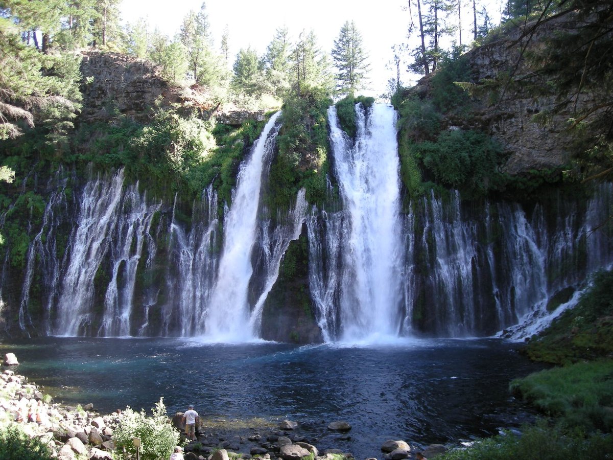
The Pacific Coast has plenty of tall waterfalls. This list is about the odd ones. One gets lit in color every night. A few let you walk behind the spray. One hides a tunnel in the rock. Another pours out of a basalt cliff from underground springs, so it keeps going when summer thins the snowmelt creeks.
We ran north to south, from Newhalem in Washington to Burney in California, and stuck to places you can legally visit on public land. Hours, fees and road status were checked on official pages on November 5, 2026. McKenzie Pass closed for the winter the same day, so Proxy Falls is a summer-and-fall stop until the highway reopens.
Ladder Creek Falls: a waterfall with a light show
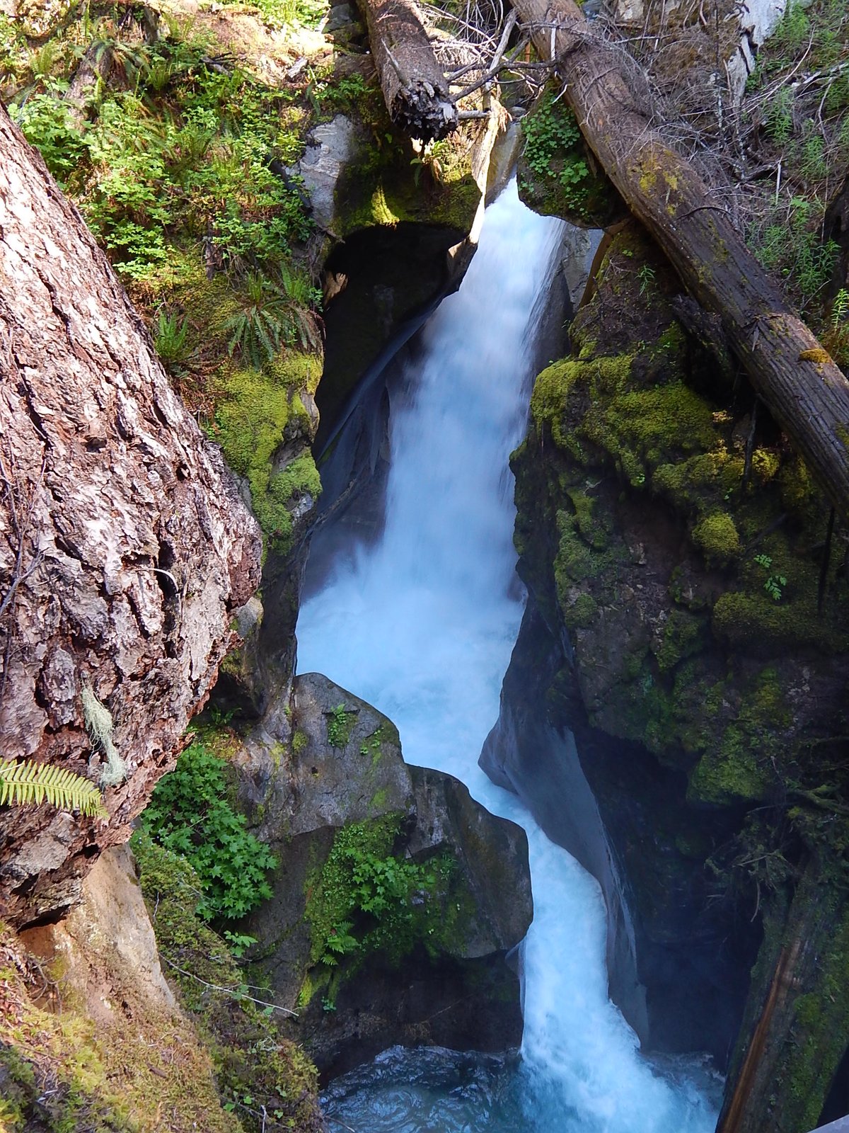
Behind Seattle City Light's Gorge Powerhouse in Newhalem, a short trail crosses a suspension bridge over the Skagit River and climbs to Ladder Creek Falls. The National Park Service puts the loop at about 0.4 mile, with steep steps and handrails. The falls and gardens have been a Skagit Hydroelectric Project stop for more than 75 years.
The odd part starts after dark. J.D. Ross, City Light's first superintendent, put colored lights on the falls in the 1920s and 1930s as a "paradise of color in the wilderness." The old system went dark by the end of 2004; City Light restored it with programmable LEDs in 2011. Seattle City Light now lists the lights from dusk to 11 p.m., with the trail open daily year-round. Bring a headlamp for the wet stairs.
Visit: Newhalem, on State Route 20 at about mile 120. Park across the river from the Gorge Powerhouse and cross the suspension footbridge. seattle.gov/city-light. Free. Lights dusk to 11 p.m. The North Cascades Highway over Washington Pass closes each winter, but Newhalem sits west of that gate, so the falls stay reachable from the I-5 side.
Tunnel Falls: walk through the rock behind the water
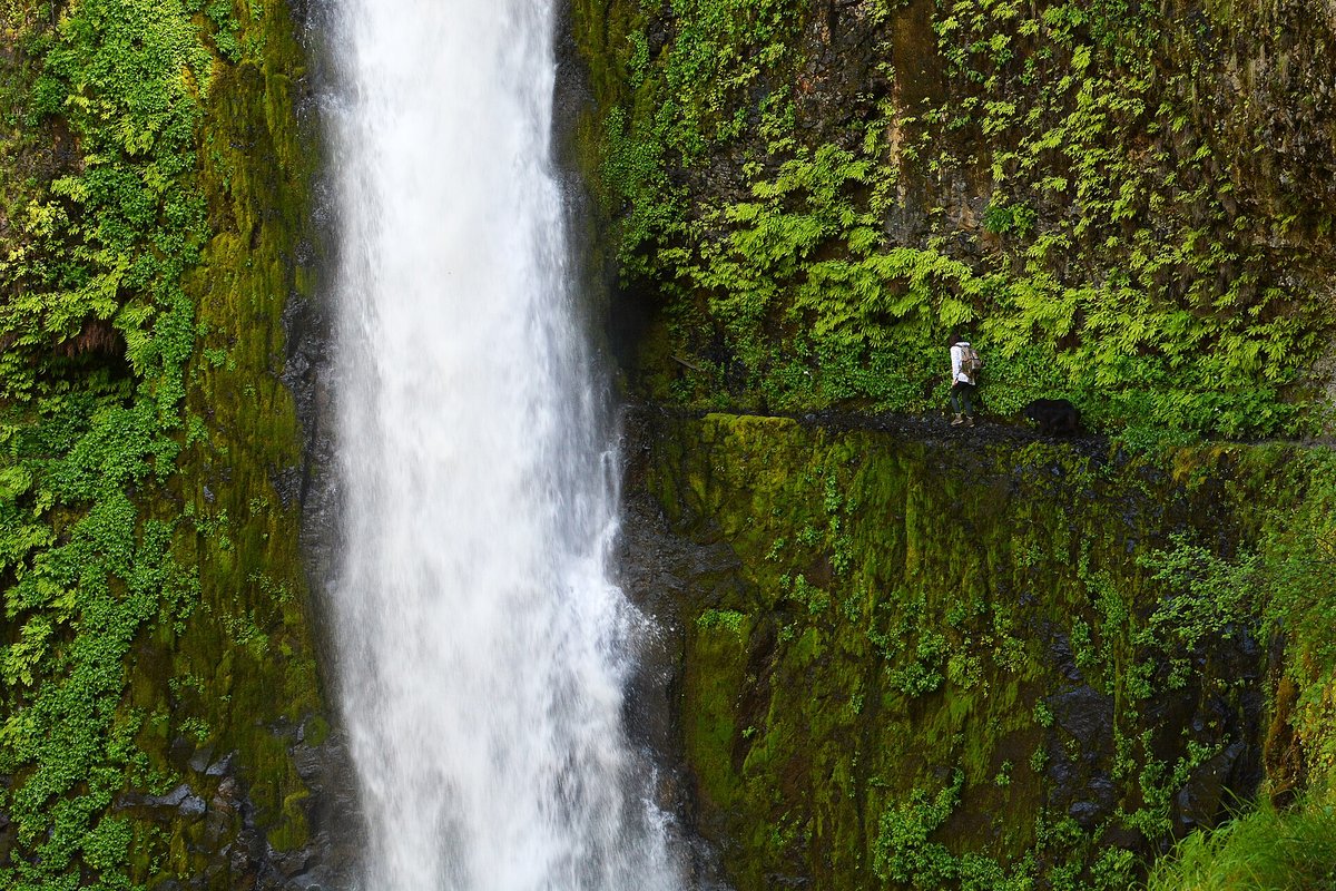
About seven miles up Eagle Creek Trail #440 in the Columbia River Gorge, the path ducks through a tunnel blasted behind Tunnel Falls so hikers can pass behind the falling water. The Forest Service calls it a cliffside hike with sheer drop-offs and no handrails on parts of the trail, and it doesn't recommend it for children or anyone uneasy with heights. Punch Bowl Falls sits on a side trail about two miles in.
The Forest Service page, updated September 16, 2026, lists the trail open, with restrooms at Big John closed for the season. Some connecting routes are still recovering from the 2017 Eagle Creek Fire, so check current alerts before you go.
Visit: Eagle Creek Trailhead, I-84 exit 41 east of Bonneville Dam. fs.usda.gov. $5 day-use fee or a valid recreation pass. Dogs on leash. Free self-issue wilderness permits are required past the Mark O. Hatfield Wilderness boundary around mile 5. Pack overnight essentials even for a day hike; cliffs and weather here have stranded people before.
Trail of Ten Falls: walk behind the spray
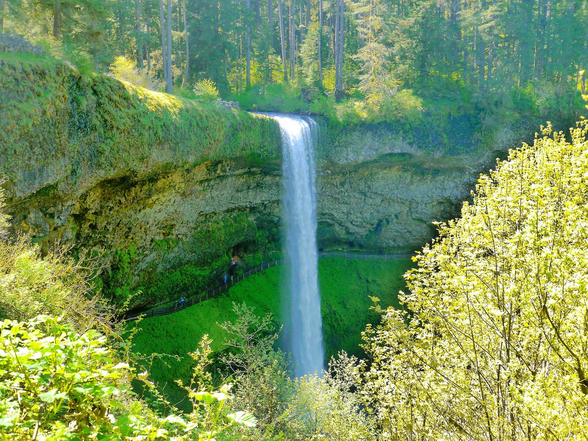
Silver Falls State Park, about 20 miles southeast of Salem, is Oregon's largest state park. The Oregon Encyclopedia puts South Falls at 177 feet. What sets the canyon apart is the Trail of Ten Falls: paths through basalt grottos so you can walk behind South Falls, Lower South Falls, Middle North Falls and North Falls.
Civilian Conservation Corps crews built the park trails and rustic structures in the 1930s, and the South Falls Lodge still anchors the day-use area. Friends of Silver Falls lists parking at $10 a vehicle per day. November through January gate hours at South Falls and North Canyon are 8 a.m. to 5 p.m. Storm damage closed pieces of the canyon trail earlier in 2026; check Oregon State Parks advisories before you count on the full loop.
Visit: 20024 Silver Falls Highway SE, Sublimity. stateparks.oregon.gov. Day-use parking $10 per vehicle. Start at South Falls for the classic walk-behind view if you're short on time, or take the longer canyon loop when it's fully open.
Proxy Falls: veils on a lava flow
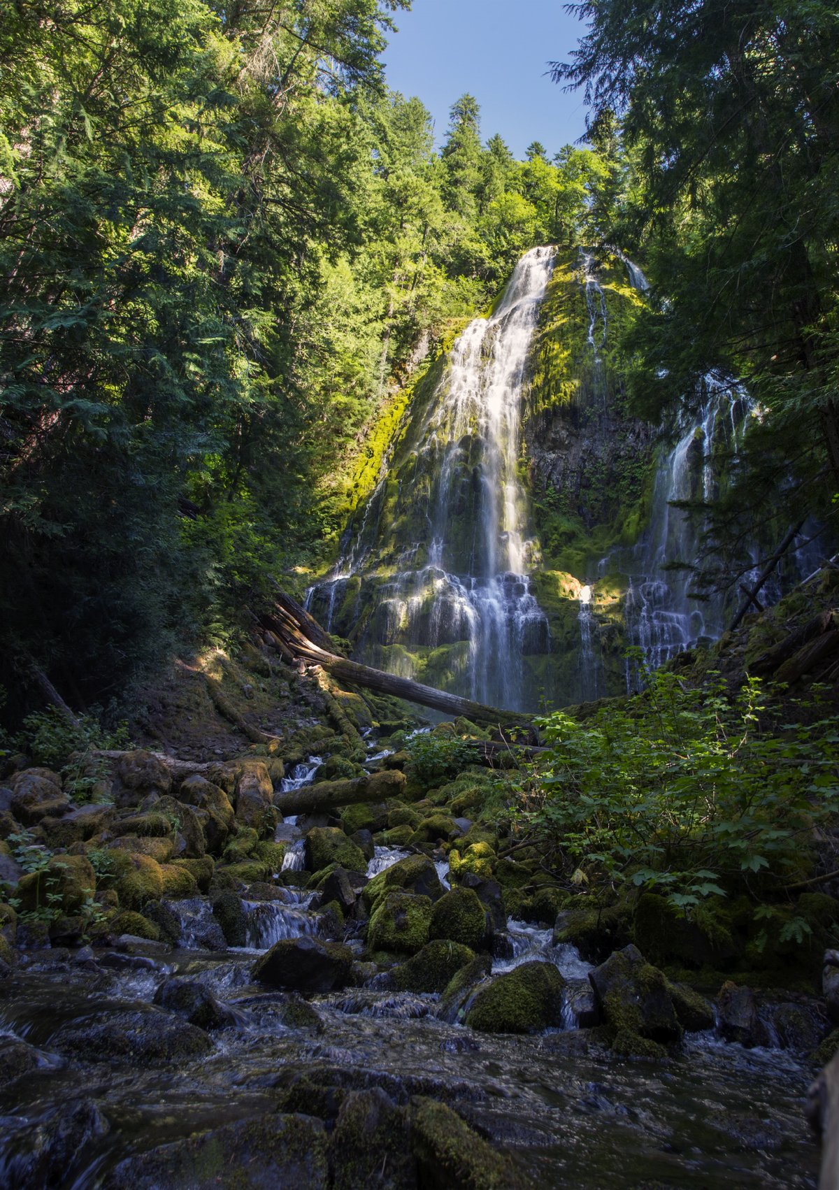
On the McKenzie Pass Highway, Proxy Falls Trail #3532 steps into the Three Sisters Wilderness, crosses an old lava flow, then splits to Lower and Upper Proxy Falls. The upper falls empties into a pool with no obvious outlet; the water is widely described as slipping under the lava toward Lost Creek. The Forest Service season for the trailhead is June through October, day use 6 a.m. to 10 p.m.
Access rides on OR 242. ODOT closed McKenzie Pass for winter on November 5, 2026, so cars are cut off until the usual mid-June reopening. When the road is open, expect a $5 day-use fee or a forest pass, plus a free self-issue wilderness permit from June 15 to October 15. Vehicles over 35 feet aren't allowed on the highway.
Visit: Nine miles east of Highway 126 on Highway 242. fs.usda.gov. Closed to cars for winter as of November 5, 2026; check tripcheck.com before you plan a summer drive. Nearby Dee Wright Observatory sits on the same pass in our Cascade volcanic oddities guide.
Salt Creek Falls: Oregon's big single drop, 50 yards from the car
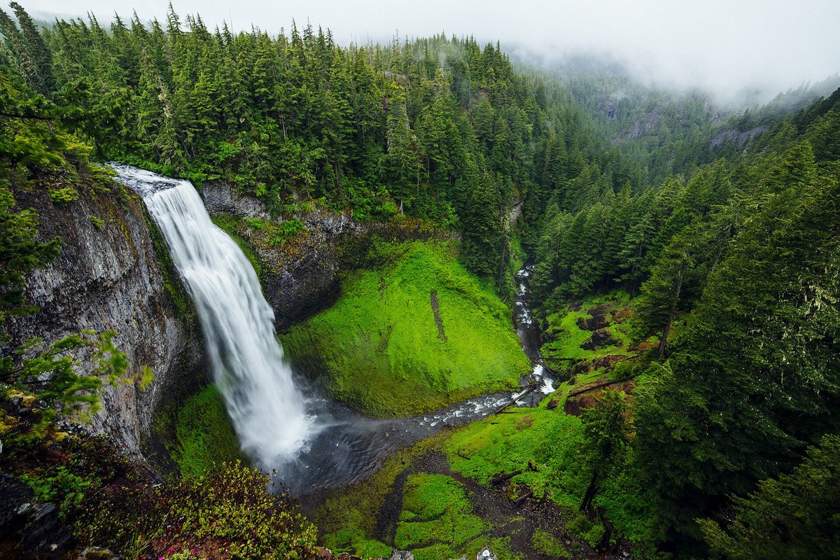
Salt Creek Falls is Oregon's second-highest single-drop waterfall, cascading 286 feet into a basalt amphitheater. The Forest Service puts the observation platform about 50 yards from the parking lot, with railings set for wheelchair sight lines, plus a paved rim loop. A steeper stair trail toward the base isn't wheelchair accessible.
It's an odd kind of easy: a deep canyon view without a long hike, with the Diamond Creek Falls Trail nearby if you want more. Day use runs sunrise to sunset for $5 or a recreation pass. In winter the lot isn't maintained; park at Salt Creek Sno-Park and walk about 0.4 mile along the road.
Visit: Off Highway 58 east of milepost 57, about 23 miles southeast of Oakridge. fs.usda.gov. $5 day-use or pass. Don't park on Highway 58.
Toketee Falls: two tiers through columnar basalt
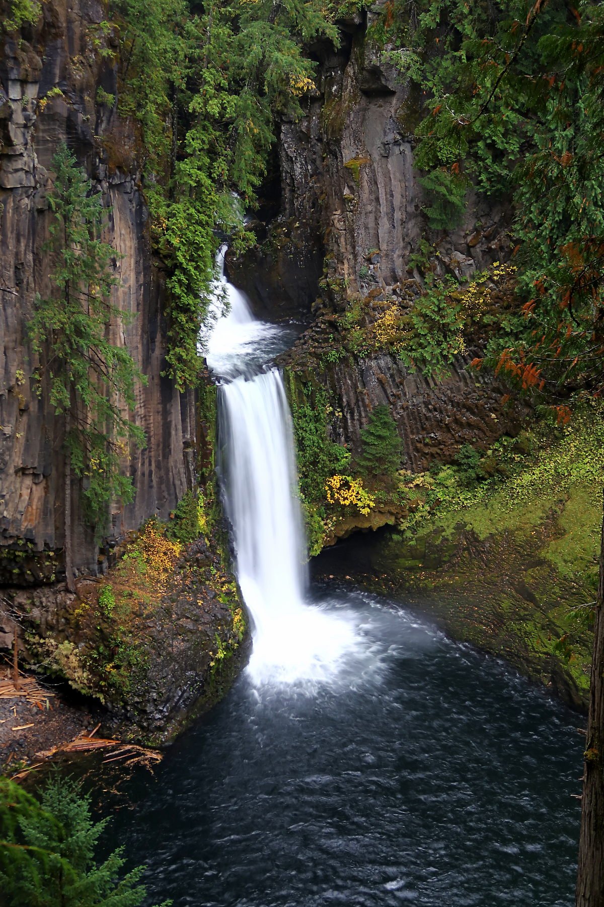
On the North Umpqua Wild and Scenic River, Toketee Falls drops in two stages through a sheer wall of volcanic basalt: 40 feet on top and 80 feet below, according to the Forest Service. Trail #1495 runs 0.4 mile each way through old-growth forest, with nearly 200 steps and a bench halfway, ending at a viewing platform. Stay behind the safety fence; leaving it has caused serious injuries and deaths.
The wooden pipe along the road belongs to the North Umpqua Hydroelectric Project and often weeps a little as the wood expands and contracts. No fee is listed for the trailhead.
Visit: Highway 138 at milepost 58.6, then Forest Road 34 (Toketee-Rigdon Road); cross the first bridge and turn left to the lot. fs.usda.gov. Free day use. North Umpqua Ranger Station: (541) 496-3532.
Burney Falls: a spring-fed curtain that keeps going
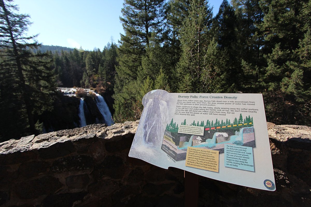
Burney Falls isn't California's tallest waterfall, and California State Parks doesn't pretend it is. The park calls the 129-foot drop its centerpiece and points to springs pouring from the basalt cliff beside the main curtain. Layered volcanic rock holds rain and snowmelt underground; State Parks puts the flow at about 100 million gallons a day, which is why the falls keep going when other Cascade creeks thin out.
Pioneer settler Samuel Burney gave the creek its name in the 1850s; the McArthur family later bought the land and gave it to the state in the 1920s. Day use runs 8 a.m. to sunset for $10 a vehicle. A 2026 summer reservation pilot on Fridays through Sundays ended September 27, though the park still fills and closes the gate on busy days. Dogs stay off the falls trails. Some creek trails north of Rainbow Bridge remain closed for erosion, but the Falls Loop to the pool is the main visit.
Visit: Six miles north of Highway 299 on Highway 89 near Burney. (530) 335-2777. parks.ca.gov. $10 day-use; pay at the entrance or the automatic machine by the visitor center in the off-season. Vehicles over 32 feet aren't admitted. Don't park on Highway 89.
Before you go
- Watch the mountain highways. McKenzie Pass (OR 242) is closed for winter as of November 5, 2026, which cuts off Proxy Falls by car. Newhalem stays open from the west when Washington Pass closes.
- Pack for mist and dark. Walk-behind trails and Ladder Creek at night are wet. A headlamp and a packable rain jacket earn their space.
- Bring the right pass. Oregon state parks, California State Parks and Forest Service day-use sites don't share one sticker. Check each stop before you leave the pavement.
- Stay on the trail at Toketee and Eagle Creek. Both managers warn that leaving the path has gotten people hurt.
For more water and rock in the same country, see Palouse Falls in our Washington geologic oddities guide, Snoqualmie Falls on the Twin Peaks route, McWay Falls on the Pacific Coast Highway and Yosemite's seasonal firefall.
Sources
- Seattle City Light: Skagit Tours and Recreation (Ladder Creek Falls lights dusk to 11 p.m.): seattle.gov
- Seattle City Light Powerlines, "Seattle City Light Restores Historic Ladder Creek Falls Light Show," Oct. 12, 2011: powerlines.seattle.gov
- National Park Service: Newhalem Area Trails (Ladder Creek Falls): nps.gov/noca
- Columbia River Gorge National Scenic Area: Eagle Creek Trailhead & Trail (#440): fs.usda.gov
- Oregon Encyclopedia: Silver Falls State Park (Zeb Larson): oregonencyclopedia.org
- Friends of Silver Falls: Hiking and Park Information: friendsofsilverfalls.net
- Oregon State Parks: Silver Falls State Park: stateparks.oregon.gov
- Willamette National Forest: Proxy Falls Trailhead and Trail #3532: fs.usda.gov
- ODOT / local press: McKenzie Pass winter closure Nov. 5, 2026
- Willamette National Forest: Salt Creek Falls Observation Site: fs.usda.gov
- Umpqua National Forest: Toketee Falls Trail: fs.usda.gov
- California State Parks: McArthur-Burney Falls Memorial State Park: parks.ca.gov
Looking for more unusual Pacific Coast trips? Start at our Oregon, Washington and California hubs, or pair this with Cascade volcanic oddities and Washington geologic oddities.
More Pacific Northwest: Oregon state guide · Cascade volcanic oddities · Oregon Coast oddities road trip · The most unique places in Oregon · Washington state guide · Washington geologic oddities · Twin Peaks filming locations · California state guide · Pacific Coast Highway oddities · Yosemite firefall