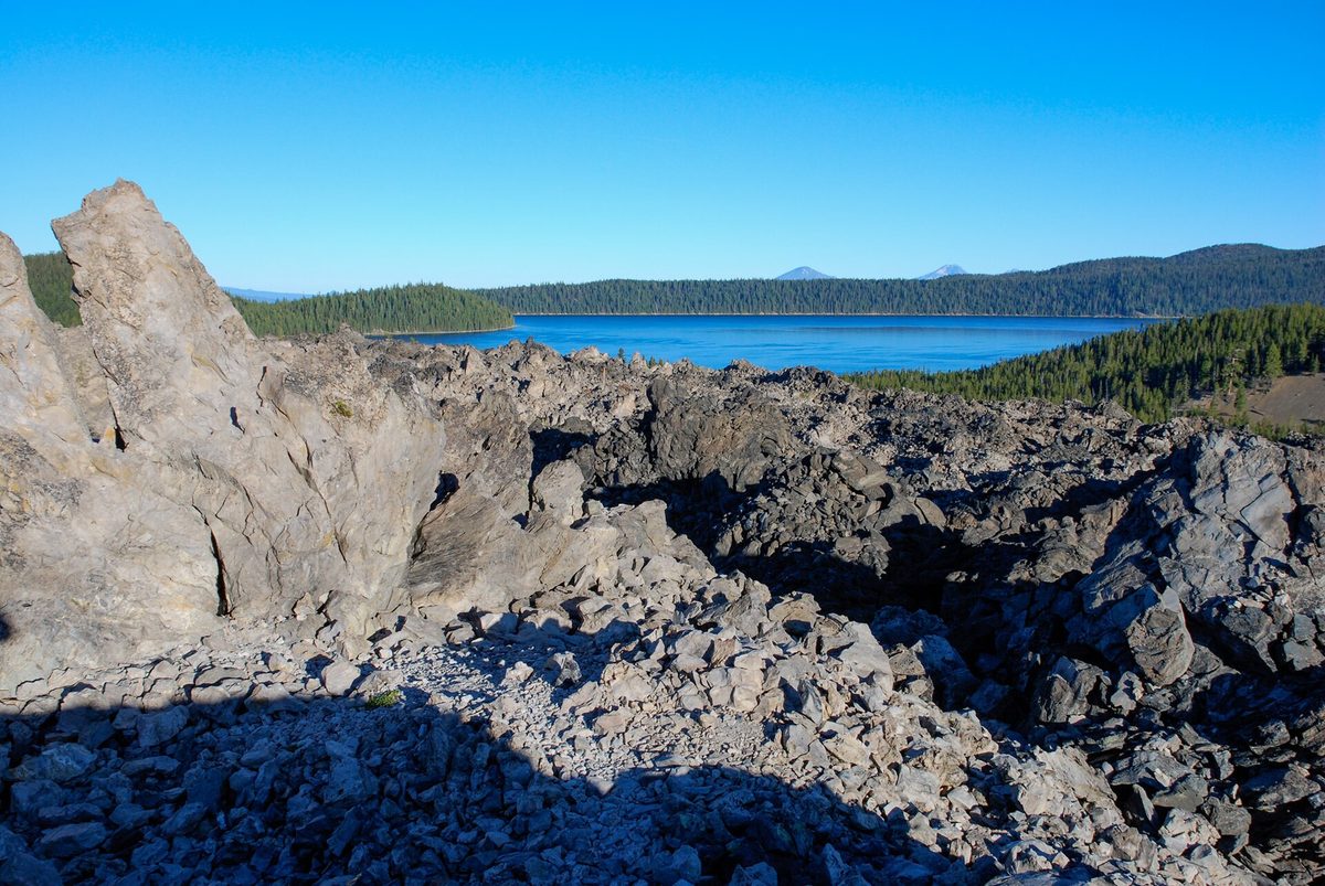
Eleven miles south of Bend on Highway 97, the pine forest stops at a wall of black, broken rock. That's the edge of Lava Butte's lava flow, about 7,000 years old, and there's plenty more like it around Bend.
All seven stops below are public. Four sit in Newberry National Volcanic Monument, created by Congress in 1990 around what the Forest Service calls the largest volcano in the Cascade Range. We checked seasons, fees and road status on official pages on October 22, 2026. Late October falls between seasons here, so each stop says what's open now and what returns in spring.
Lava Butte and Lava Lands: a cinder cone with a lookout on top
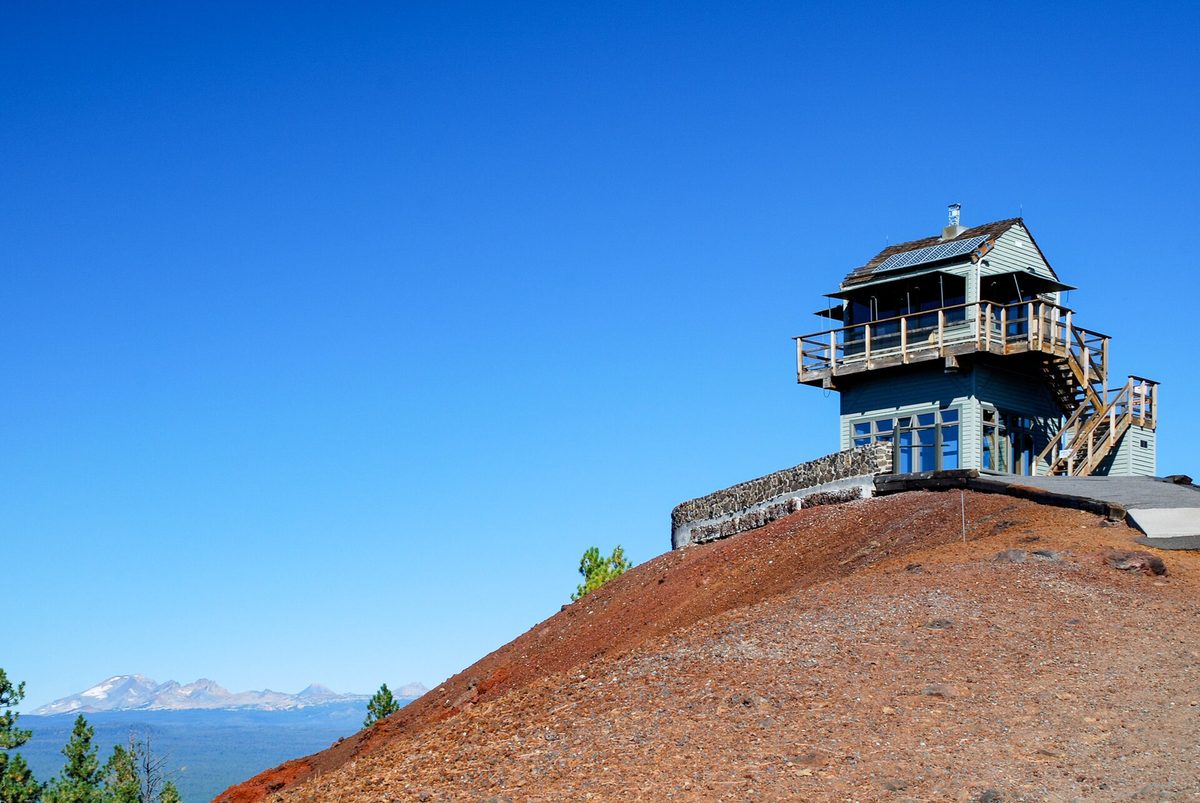
Lava Butte rises 500 feet above the Lava Lands Visitor Center, all red cinders on top and black lava at its feet. The USGS says it erupted about 7,000 years ago along the Northwest Rift Zone, a fissure system that opened for roughly 20 miles northwest of Newberry's caldera. Its lava covers about nine square miles and briefly dammed the Deschutes River.
The summit has a working fire lookout. The Forest Service says it was first used as one in 1913 and is still staffed. You're welcome in the room underneath, where panoramic photos label the peaks, and a quarter-mile trail loops the crater rim.
Visit: 58201 S. Highway 97, Bend. (541) 593-2421. fs.usda.gov. $5 per vehicle or a valid recreation pass. The visitor center's 2026 season ended October 11; the $5 shuttle to the top ran June 13 to September 7. Summit driving permits are issued only while the center is open, so until spring the top is a walk or bike ride, dawn to dusk.
Lava River Cave: a mile of tube under the highway
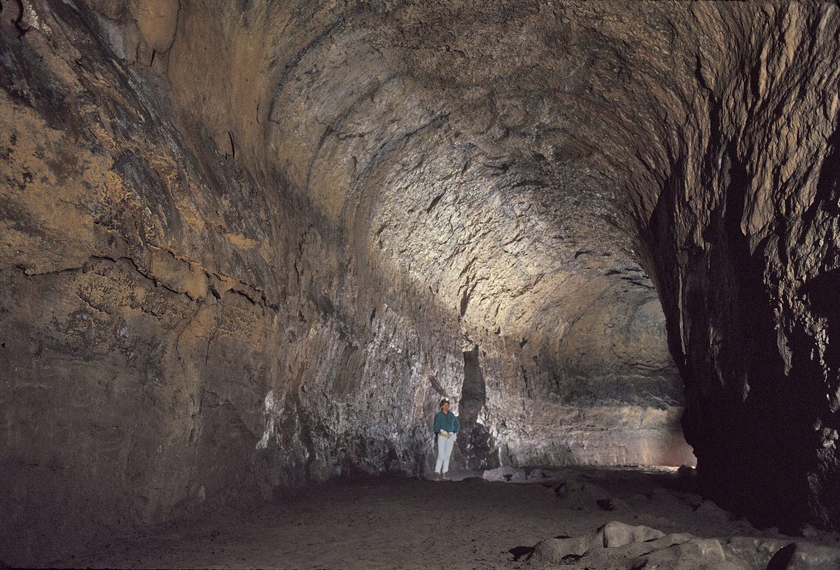
Lava River Cave is the longest lava tube in Oregon, about a mile long, and the Forest Service dates it to Newberry eruptions roughly 65,000 years ago. Partway in, the tube passes under Highway 97, where the rock ceiling is about 50 feet thick.
It's a self-guided walk in total darkness at about 42°F, summer or winter. You go down 55 stairs at the entrance and take about 180 in all, past spots the Forest Service map calls Echo Hall, Low Bridge Lane, the Two Tube Tunnel and the Sand Gardens. Plan on 2.2 miles round trip and about 90 minutes.
Bats live here, which explains the rules. Clothing and gear used in any other cave or mine stay outside, to keep white-nose syndrome out, and the cave closes outside its season to protect bat habitat.
Visit: Highway 97 Exit 151 (Cottonwood Road), about a mile from the exit. fs.usda.gov. Closed now. The 2026 season ran May 15 to September 15, Friday through Monday, 9 a.m. to 4 p.m., last entry 2 p.m. Parking takes a timed reservation on Recreation.gov, one per vehicle, free plus a $2 processing fee, and you'll also need a $5 day pass or a recreation pass. Slots release seven days and 24 hours ahead at 7 a.m. Pacific. Lights rent for $7, and pets stay home.
Lava Cast Forest: holes where trees used to be
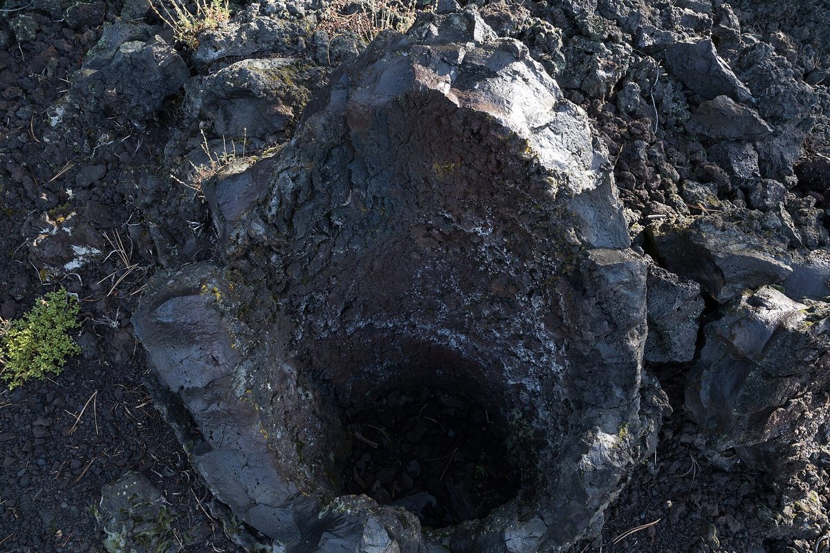
The same rift eruptions that built Lava Butte sent runny lava into an old-growth forest. It flowed around the trunks, the wood burned away, and the cooled rock kept the shape of each tree. The hollow molds are still there, some upright like stone wells.
A paved one-mile loop with about 150 feet of climb takes you past many of them. It's a National Recreation Trail, and the brochure at the trailhead explains what you're looking at. It's our pick for kids, because the molds make a lava flow easy to picture.
Visit: About 15 miles south of Bend on Highway 97, then 10 miles east on Forest Road 9720. fs.usda.gov. The road is gravel the Forest Service calls rarely maintained, so go slow. $5 per vehicle or a recreation pass, with no payment on site, so buy your pass first. Open May until snow blocks the road.
Big Obsidian Flow: Oregon's youngest lava is glass
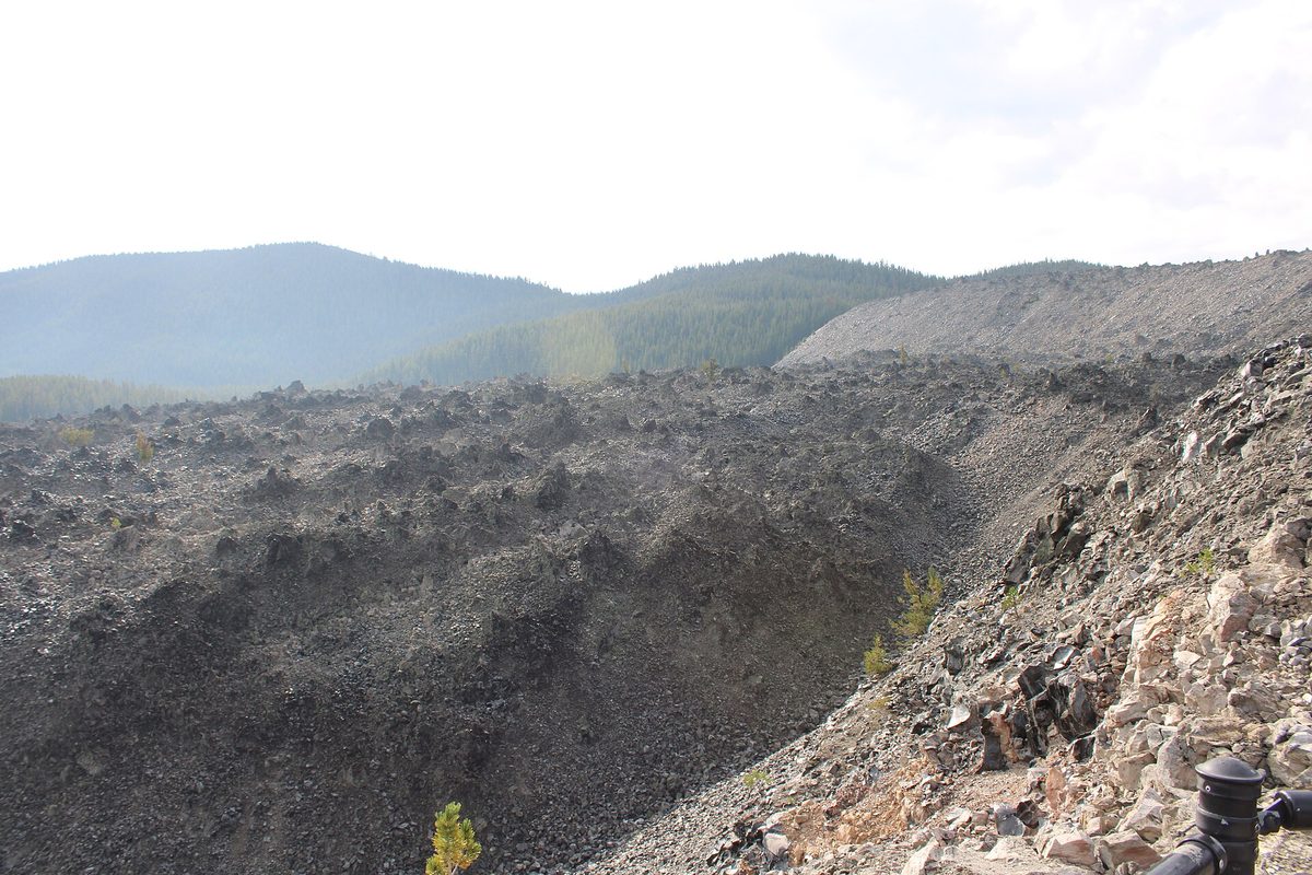
Newberry's caldera is five miles across and holds two lakes, Paulina and East. On the caldera's south side sits the Big Obsidian Flow, the youngest lava flow in Oregon at about 1,300 years old. The USGS describes three stages: a tall column of pumice, then an ash flow toward Paulina Lake, and last a gas-poor lava that oozed out as obsidian, a natural glass with no crystals. Ash from the eruption reached Idaho.
A one-mile loop with stairs climbs right onto the flow, which covers about a square mile. Up close the glass is glossy and black. Leave every flake where it lies. Collecting rock is illegal in the monument, and both visitor centers sell legally sourced obsidian if you'd like a piece to take home.
On the drive in, stop for Paulina Falls, an 80-foot twin waterfall a short walk from its parking area.
Visit: 24 miles south of Bend on Highway 97, then 15 miles east on Paulina Lake Road (County Road 21). fs.usda.gov. $5 per vehicle or a recreation pass. Trail season runs June to late fall. As of October 20, 2026, the Forest Service listed Paulina Lake Road open, but driving access to Paulina Peak closed for the season on October 6, and Paulina Visitor Center's 2026 season ended September 28. Deschutes County closes the road each winter.
Pilot Butte: a volcano inside Bend
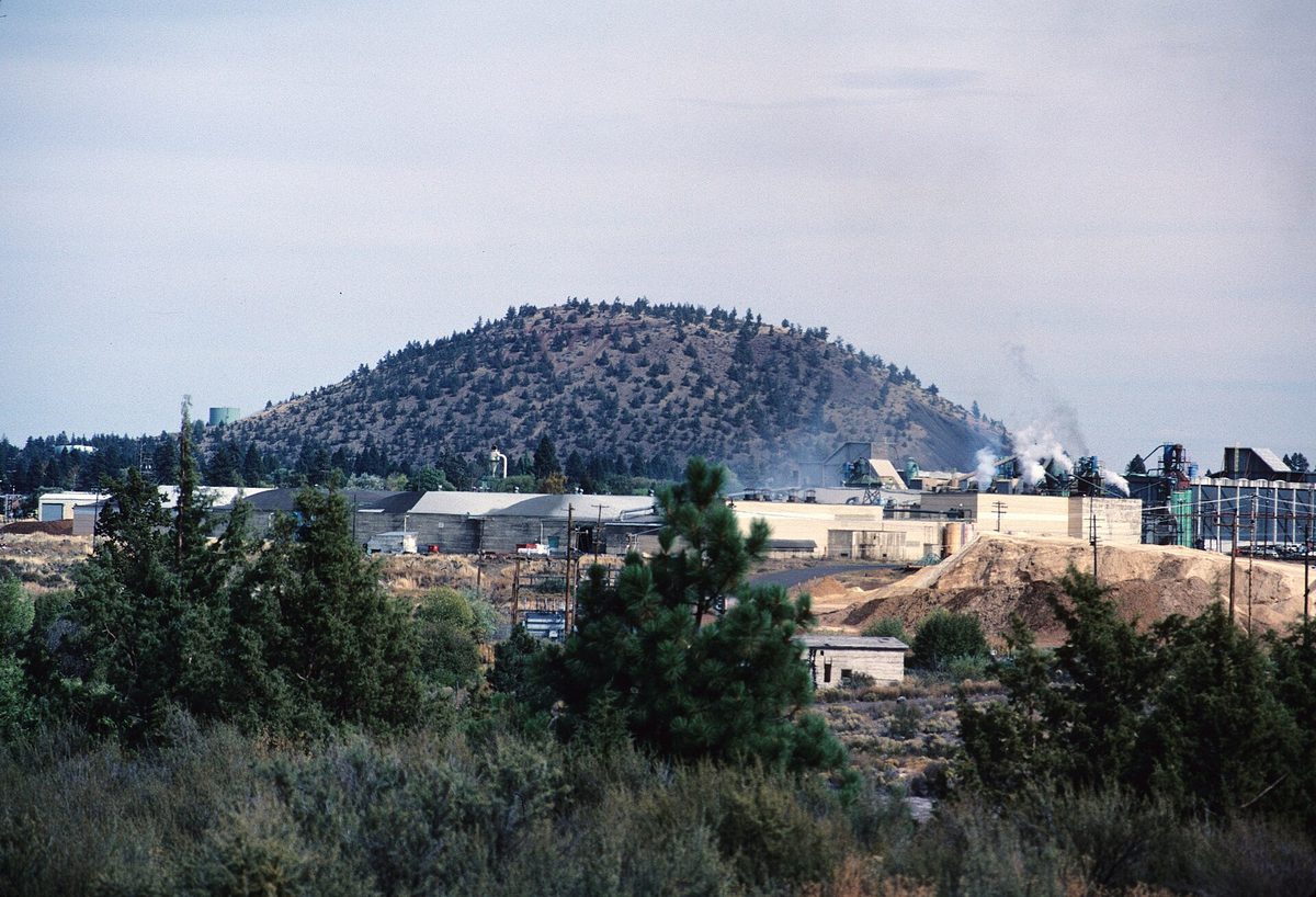
Bend has its own volcano. Pilot Butte is an extinct cinder cone on the east side of town, 480 feet tall, and its land went to the state in 1927, a gift from Terrence Hardington Foley's Bend business associates in his memory. Wagon trains used it as a landmark while looking for a safe place to cross the Deschutes.
Two routes go to the top, a mile-long nature trail and a mile-long paved road, and the summit view takes in the Three Sisters, Mount Jefferson, Black Butte and Mount Hood. Go at sunset, when the snow on the Cascades turns gold.
Visit: 1310 NE Highway 20, Bend. (541) 388-6055. stateparks.oregon.gov. The trails and summit are open on foot all year from the east-side parking lot. The summit road was open to cars May 1 to September 30, 10 a.m. to dusk. Gate work off Highway 20 runs through October 30, 2026.
Dee Wright Observatory: a stone lookout on a lava field
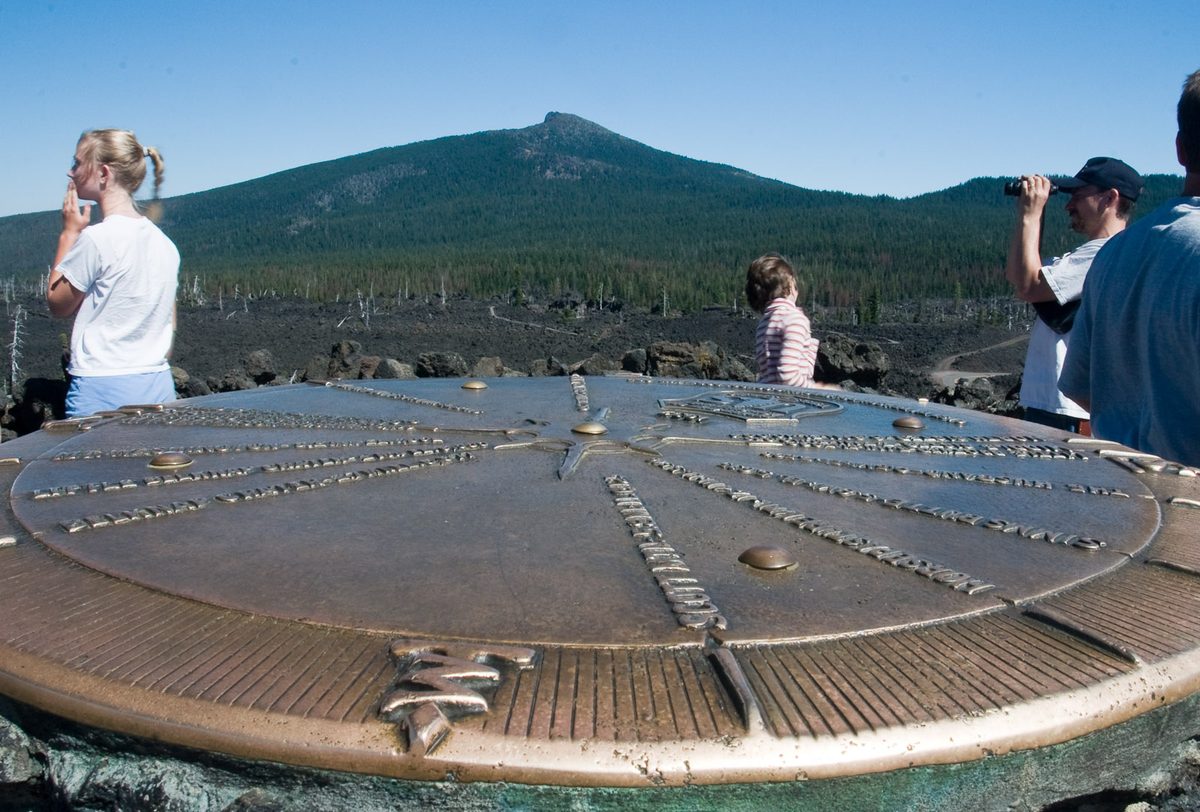
Highway 242 climbs west from Sisters to McKenzie Pass, and near the top the forest gives way to lava in every direction. The Forest Service says the view covers 65 square miles of it, and that NASA ran drills here with astronauts in 1964 as they prepared for the moon.
The Civilian Conservation Corps finished the stone observatory in 1935 and named it for Dee Wright, the crew's foreman, who had died the year before. Inside, openings in the walls each frame a peak. On the roof, a bronze peak finder gives the names and elevations of the mountains around you. On a clear day you can pick out Mount Washington, Mount Jefferson, all Three Sisters and Mount Hood, 78.5 miles north.
Next door, the paved half-mile Lava River Trail winds through lava from Yapoah Crater, about 2,000 to 2,700 years old, with signs that explain the shapes the lava took. The trail is accessible.
Visit: 15 miles west of Sisters on Highway 242, at 5,187 feet. fs.usda.gov. No fee. Vehicles over 35 feet are prohibited on the highway. As of October 20, 2026, the Forest Service listed Highway 242 open. ODOT usually closes it the Thursday before Veterans Day, which this year is November 5, and reopens it around the third Monday in June; it reopened June 15 this year. Snow can move either date, so check TripCheck before you drive up.
Smith Rock: a supervolcano, 30 million years on
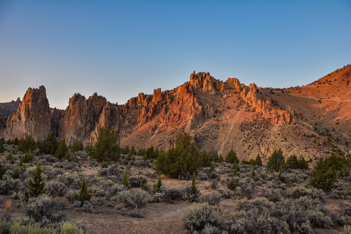
Smith Rock is the old-timer here. Its orange cliffs and spires are tuff, volcanic ash welded into rock, from the Crooked River caldera, a 26-by-17-mile supervolcano that erupted between about 29.7 and 27.5 million years ago. That's per an Oregon Encyclopedia entry co-written by DOGAMI geologist Jason McClaughry.
About 400,000 years ago, lava from Newberry flowed north and pushed the Crooked River up against the tuff, and the river has been carving it since. You get a 600-foot cliff above a bend in the river and more than 2,000 climbing routes.
Visit: Near Terrebonne, north of Redmond. (541) 548-7501. stateparks.oregon.gov. Open dawn to dusk. Day-use parking is $10 per vehicle for Oregon residents and $12 for nonresidents, or $60 and $75 for a 12-month permit. Drones are prohibited. From December 1, 2026, to May 31, 2027, construction will close the overflow lot, the North Point Loop Trail and parts of the Rim Rock Trail at times. Some climbing areas close from about January 15 to August 1 for nesting golden eagles and falcons.
Before you go
- Buy your pass first. Every Deschutes National Forest stop here takes a $5 day pass, a $30 Northwest Forest Pass or an $80 interagency pass, and Lava Cast Forest has no pay station. Smith Rock runs on its own Oregon State Parks permit.
- Watch the calendar. ODOT's usual pattern would close Highway 242 on November 5, Paulina Lake Road closes for winter, and Lava River Cave reservations open a week ahead once the season starts in May.
- Pack layers and two lights. The cave holds at 42°F, and the Forest Service recommends two light sources per person. A headlamp keeps your hands free on the stairs, and an Oregon road atlas helps where cell service fades.
- Plan the loop. Lava Butte, the cave and Lava Cast Forest share Highway 97 south of Bend. Save most of a day for Newberry Caldera, and pair Dee Wright with Smith Rock through Sisters and Redmond.
Central Oregon's volcanoes are close enough to Bend to see in a long weekend, and most are young enough that the rock still looks raw. Walk on the glass this fall, watch the sun go down from Pilot Butte, and save the cave for May.
Sources
- USDA Forest Service, Deschutes National Forest: Lava Lands Visitor Center, Lava Butte, Lava River Cave, Lava Cast Forest, Big Obsidian Flow, Paulina Peak and Paulina Visitor Center pages: fs.usda.gov
- Deschutes National Forest, Current Conditions (road status), updated October 20, 2026: fs.usda.gov
- Lava River Cave Timed Reservation Tickets: recreation.gov
- Newberry National Volcanic Monument, "Volcanic Vistas" visitor guide, 2025: fs.usda.gov (PDF)
- USGS Volcano Hazards Program, "Post-Mazama Eruption Products" and "Big Obsidian Flow": usgs.gov
- Deschutes County Road Department, News and Closures (Paulina Lake Road): deschutescounty.gov
- USDA Forest Service, Willamette National Forest: Dee Wright Observatory and Lava River National Recreation Trail #3540: fs.usda.gov
- ODOT, "McKenzie Pass opens Monday," June 12, 2026, and McKenzie Highway page: oregon.gov/odot
- Oregon State Parks: Pilot Butte State Scenic Viewpoint (park page and Nature Trail guide): stateparks.oregon.gov
- Oregon State Parks: Smith Rock State Park and Day-use Parking Permits: stateparks.oregon.gov
- Jason McClaughry and Paul Patton, "Smith Rock State Park," Oregon Encyclopedia, April 20, 2022: oregonencyclopedia.org
Looking for more unusual Oregon trips? Start at our Oregon hub, or see Oregon's most unusual small towns, the Oregon Coast oddities road trip, and haunted places in Oregon, fact-checked.
More Oregon: Oregon state guide · The most unique places in Oregon · Oregon scenic road trip · Oregon Coast oddities road trip · Oregon places with a haunted reputation · Haunted places in Oregon, fact-checked · Oregon's most unusual small towns